Catalog Archive
Auction 133, Lot 275

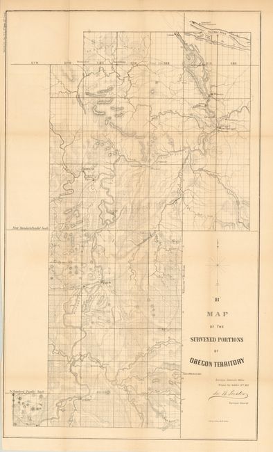
"Map of the Surveyed Portions of Oregon Territory", General Land Office

Subject: Oregon

Period: 1852 (dated)

Publication: Senate Ex Doc. 1, 2nd Sess. 32nd Congress

Color: Black & White

Size:
15 x 25.5 inches
38.1 x 64.8 cm
Download High Resolution Image
(or just click on image to launch the Zoom viewer)

This is an early land office map which details the central valley from Albany to Portland. Locates Marysville, Syracuse, Salem, Fairfield, Lafayette, Oregon City and Milwaukee. Locates Fort Vancouver across the Columbia River from Portland. Good detail of early wagon roads, watershed and topography. Signed in the plate by John B. Preston, the first Surveyor General of Oregon. Drawn in Oregon City on October 21, 1852. Lithographed by A. Hoen & Company of Baltimore.

References:

Condition: B+

Very nice example with light toning on some folds.

Estimate: $100 - $140

Sold for: $75

Closed on 9/1/2010

Archived