Catalog Archive
Auction 133, Lot 259

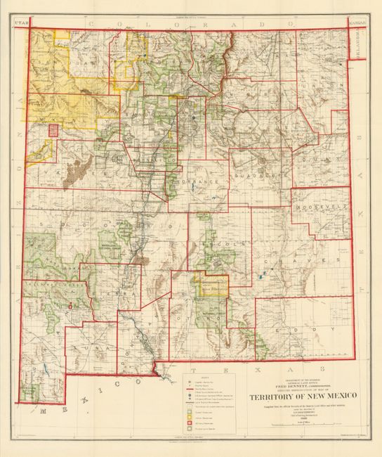
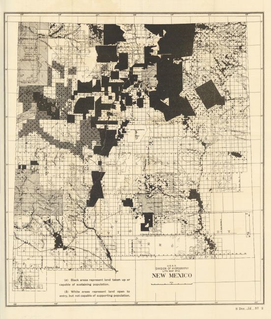
"Territory of New Mexico [and] New Mexico", General Land Office

Subject: New Mexico

Period: 1902-08 (dated)

Publication:

Color: Printed Color

Size:
See Description
Download High Resolution Image
(or just click on image to launch the Zoom viewer)

The first map is the Department of the Interior's Territory of New Mexico produced when Fred Dennett was its commissioner. This General Land Office map is dated 1908 and features fine printed color, (17.6 x 20.8"). It is a colorful and fascinating map published only four years before New Mexico obtained statehood. The map shows incredible detail of the extent of existing Indian reservations, Military reservations, Forest Reserves and Private Land Grants through color and pattern. The brown hachure indicating the mountains plus all the other colors used on the map combine to provide great visual impact. Filled with information on watershed, mountains, railroads, wagon roads, unsurveyed townships, etc. The map was compiled by I.P. Berthrong, Chief of Drafting Division, traced and lettered by Wm. Baaman. Lithographed by the Eckert Lithographing Co, Washington, D.C. Beautiful example.

The second map, New Mexico was created by the USGS Division of Hydrography in 1902, black & white, (16.8 x 19"). It was published as Sen. Doc. 36, 57th Congress, 2nd Session. This uncommon map uses solid black to block out areas representing "land taken up or capable of sustaining population." The remainder of the territory is "land open to entry, but not capable of supporting population." Your intrepid cataloger wonders what on earth does that mean?

References:

Condition: A+

Estimate: $150 - $250

Sold for: $95

Closed on 9/1/2010

Archived