Catalog Archive
Auction 133, Lot 253

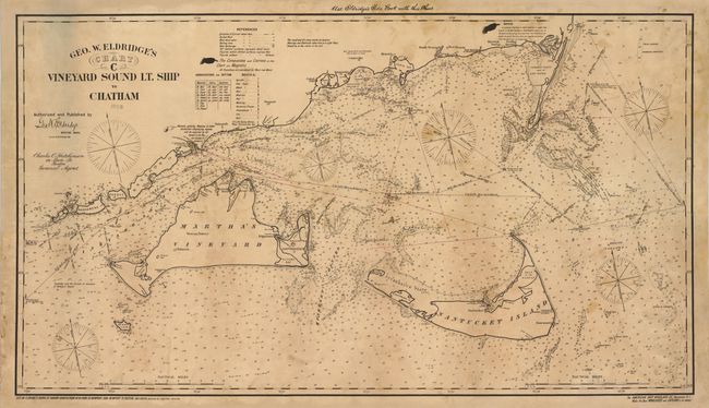
"Geo. W. Eldridge's Chart C Vineyard Sound Lt. Ship to Chatham", Eldridge, George

Subject: Massachusetts

Period: 1908 (dated)

Publication:

Color: Black & White

Size:
46.8 x 26.5 inches
118.9 x 67.3 cm
Download High Resolution Image
(or just click on image to launch the Zoom viewer)

This large, linen backed sea chart is from Eldridge's series of New Coast Charts that covered the northeastern coast from New York to Maine. covers Martha's Vineyard, Nantucket Island and the adjacent coastline of Massachusetts. There is excellent navigational detail throughout the chart. The legend locates 13 different type of buoys, prevailing currents, light houses, anchorages, rocks, shoals, bottom types and fishing grounds. Dotted lines illustrate the shipping lanes including distances between ports. On verso is the original paper label with title, with a price of $1.60, and a list of the other charts in the series.

References:

Condition: B+

Toned with some light stains and some professional repairs. Overall very good for a working nautical chart.

Estimate: $2,400 - $3,000

Unsold

Closed on 9/1/2010

Archived