Catalog Archive
Auction 133, Lot 251

"Map of the City of Lowell, Massachusetts", Sampson, Murdock & Co

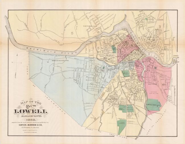
Subject: Lowell, Massachusetts

Period: 1888 (dated)

Publication:

Color: Hand Color

Size:
24.2 x 18 inches
61.5 x 45.7 cm
Download High Resolution Image
(or just click on image to launch the Zoom viewer)

This uncommon town plan provides excellent detail of all streets, each named, and many prominent places including rail station and depot, fair grounds, cemeteries, common grounds and a park. Lowell's location along the Merrimack River and its many falls led to the building of mills and early prominence as a manufacturing town. Several mills along the river front are named, as are other important buildings. Locates Belvedere, Middlesex Village, Centerville, Pawtucket Ville and Ayer City. Delineates the tracks of the Boston, Lowell & Nashua; the Lowell, Lawrence & Salem; and the Framingham & Lowell railroads.

References:

Condition: B+

Issued folded, now flattened with tissue repairs on verso at most folds for support. Wide margins.

Estimate: $120 - $160

Unsold

Closed on 9/1/2010

Archived