Catalog Archive
Auction 133, Lot 249

"Geological Map of Massachusetts", Hitchcock, Edward

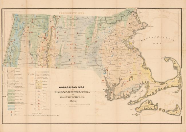
Subject: Massachusetts

Period: 1832 (dated)

Publication: First Report of the Geological Survey of the Commonwealth

Color: Hand Color

Size:
27.7 x 18 inches
70.4 x 45.7 cm
Download High Resolution Image
(or just click on image to launch the Zoom viewer)

This 1832 issue is the first edition of Hitchcock's important map. This colorful map has an extensive legend with twenty geological formations shown through color and design, plus symbols to further locate deposits of plumbago, coal, peat, iron, lead, copper, and manganese. Hitchcock was an eminent professor of chemistry and natural history at Amherst College and was selected in 1830 to conduct a general survey of the Commonwealth of Massachusetts. He was the State Geologist 1830-33 and 1841-44. The publication of his first report and this map in 1832 marked an epoch in American geological work as it was the first geological survey of an entire state conducted at public expense. It is also a fine example of early lithography by Pendleton's Lithogy., Boston. Hitchcock's maps were issued in small quantities and are seldom seen in sound condition.

References: Schwartz & Ehrenberg plt.159; Marcou & Marcou No. 200; Phillips (M) p. 401.

Condition: B+

A nice example that has some offsetting visible in blank areas and one fold in upper left margin is split.

Estimate: $400 - $500

Sold for: $425

Closed on 9/1/2010

Archived