Catalog Archive
Auction 133, Lot 243

"[Facsimile Reproduction] This Map of Kentucke, Drawn from actual Observations, is inscribed with the most perfect respect to the honorable the Congress of the United States of America…", Filson, John
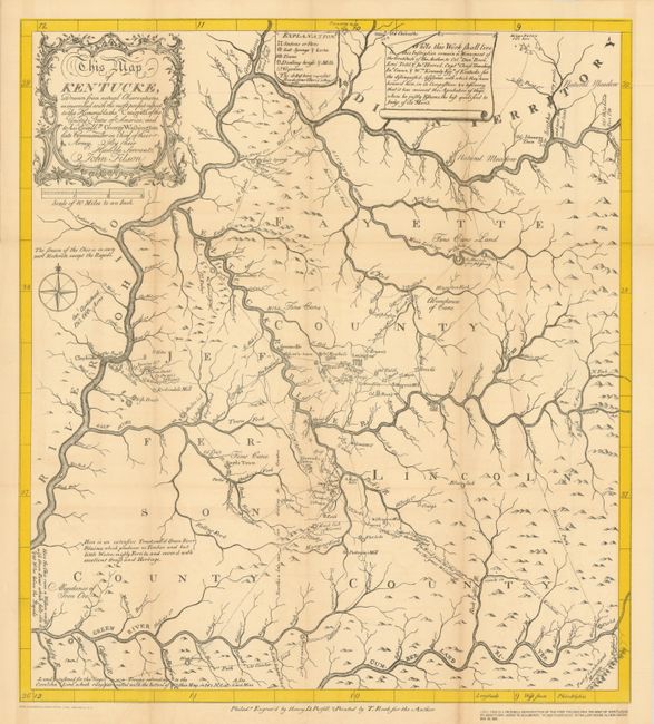
Subject: Kentucky

Period: 1929 (dated)

Publication:

Color: Black & White

Size:
17.5 x 19.6 inches
44.5 x 49.8 cm
Download High Resolution Image
(or just click on image to launch the Zoom viewer)

This is a reproduction of Filson's landmark and very rare map of Kentucky, rarer still as it is an English language edition. At lower left "Note: This is a facsimile Reproduction of the First Philadelphia 1784 Map of Kentucke by John Filson, issued to accompany "Filson's Kentucke" by Willard Rouse Jillson, December 20, 1929". Probably issued as a Filson Club Publication. Blank verso. John Filson (1753 - 1788) was the first Historian of Kentucky. Moving from Pennsylvania about 1782, he settled in Lexington where he divided his time between teaching and surveying land claims. He wrote The Discovery, Settlement and Present State of Kentucke in 1784. The "Map of Kentucke" was engraved and printed in Philadelphia and was reprinted several times prior to 1793 but his plan for a second edition was not realized. He purchased land at the junction of the Ohio and Licking rivers, the future site of Cincinnati, which he named Losantiville. His survey and plan of the town is visible in the structure of today's downtown Cincinnati. In 1788 while on a surveying expedition near the Great Miami River, he disappeared when the party was attacked by Shawnee Indians.

References:

Condition: B+

Trace of fold toning and three small fold intersection splits. Folding as issued.

Estimate: $80 - $120

Unsold

Closed on 9/1/2010

Archived