Catalog Archive
Auction 133, Lot 240

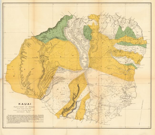
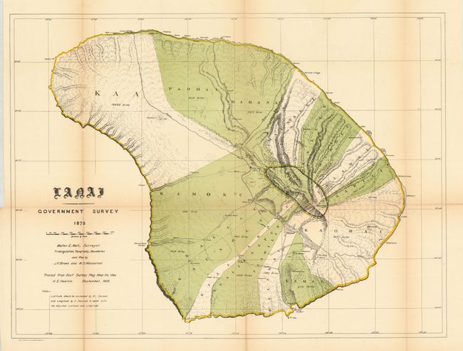
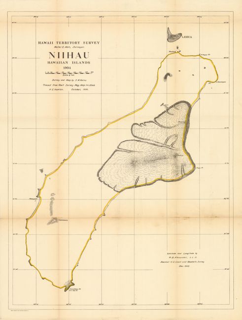
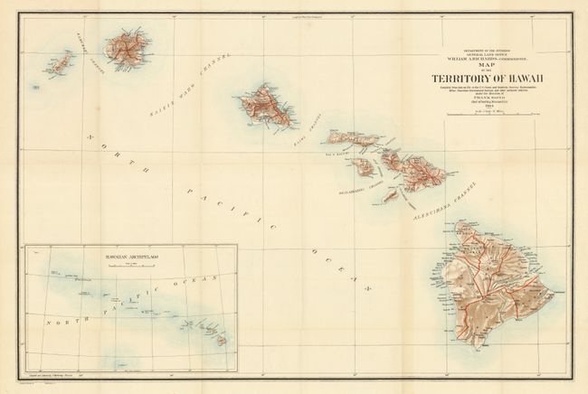
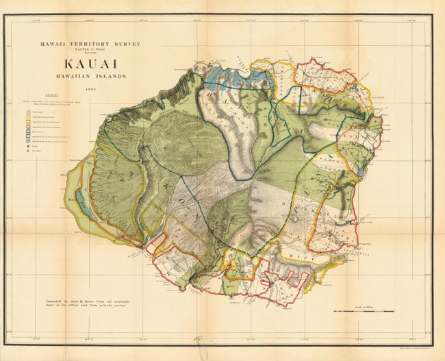
"[Lot of 5 Hawaii Territorial Surveys Maps]", Hawaii Territorial Surveys

Subject: Hawaii

Period: 1901 (dated)

Publication:

Color: Printed Color

Size:
23 x 19.5 inches
58.4 x 49.5 cm
Download High Resolution Image
(or just click on image to launch the Zoom viewer)

1. Kauai Territory of Hawaii, 23" x 19.5". This uncommon and brightly colored map details the topography of the island. It also locates the Koloa Plantation, Princeville Plantation, etc. The map uses color to distinguish Crown lands, awarded to King Kamehameha III in 1848, in yellow, the Public lands in green and private lands left uncolored. Great detail of coastal regions with all points, bays and beaches named. Hawaii's monarchy was overthrown in 1893, and this map was prepared in August 1901 by Herbert E. Newton from the Gov't Survey map No. 1395. Printed by the Julius Bien Photo Lithography firm. Issued folding, now backed with archival tissue. Toned on one fold. (B+)

2. Lanai Government Survey 1878, 1906, 26.3" x 19.6". Fascinating, detailed and early survey of the island by Walter E. Wall. Triangulation, topography and boundaries by J.F. Brown and M.D. Monsarrat. The island is divided into at least ten regions, all named and shown via coloration, with acreage's given. Locates harbors, rocks, anchorages, school house, village, and peaks with elevations. A charming and unusual map of this beautiful island. Paper has several splits on folds with toning, should be backed. (C+)

3. Niihau Hawaiian Islands 1904, 1906, 19.3" x 25.4". Map shows shoreline and the volcanoes of Kawaewae, Kawaihoa, Puulua, Paniau and Kaeo in good detail, otherwise the interior is completely blank. Also shows the island of Lehua. Survey and map were accomplished by S.M. Kerns with latitude and longitude by W.D. Alexander of the USGS. Originally issued in 1904 this is the October 1906 updated edition. Drawn on a scale of 1 inch = 4000 feet. Niihau is the smallest inhabited island in the Hawaiian chain, but is also the only privately owned island in Hawaii, gaining it the nickname the Forbidden Island. The story of the owner is fascinating. Issued folding the map is now backed with archival tissue to support one weak fold with toning. (B+)

4. Map of the Territory of Hawaii, 1904, 32.8" x 22". A large, colorful map of the Hawaiian Islands developed shortly after annexation and with little settlement shown outside of Oahu. The Mauna Loa volcano is shown with its lava flows. The chart was "compiled from data on file in the U.S. Coast and Geodetic Survey: Hydrographic Office: Hawaiian Government Surveys, and other authentic sources under the direction of Frank Bond chief of drafting division." Published under the direction of the commissioner William A. Richards. Large inset, compiled by I.P. Berthrong (12.5 x 7.5"), gives a wider view of the entire archipelago, extending beyond Midway Island. Good detail on a scale of 1 inch = 12 miles. Folding as issued with full margins and fine impression and color. Very light toning near a fold, else fine. (A)

5. Hawaii Territory Survey - Kauai Hawaiian Islands, 1903, 30" x 23.4". Brilliantly colored and detailed map of Kauai with information on pineapple and sugar plantations, homesteads, public lands, swampland and unsurveyed areas. This very attractive example delineates public and private family holdings as well as rice fields, sugar plantations, roads, schools, forts and the location of a wireless telegraph pole. Hawaii's monarchy was overthrown in 1893, and this map was prepared for the Governor's Annual Report of 1906. The governor at this time was George R. Carter. Compiled by John M. Donn "from all available data in the office and from private surveys." A handsome chart that was printed by the firm of Andrew B. Graham, Lithographers, Washington, D.C. Paper has several splits on folds with toning, should be backed. (C+)

References:

Condition: B+

Issued folding, now backed with archival tissue. Toned on one fold.

Estimate: $350 - $450

Sold for: $190

Closed on 9/1/2010

Archived