Catalog Archive
Auction 133, Lot 223

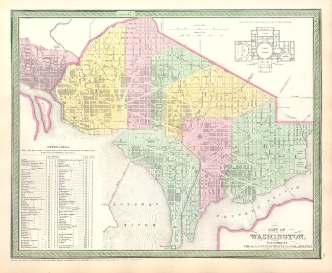
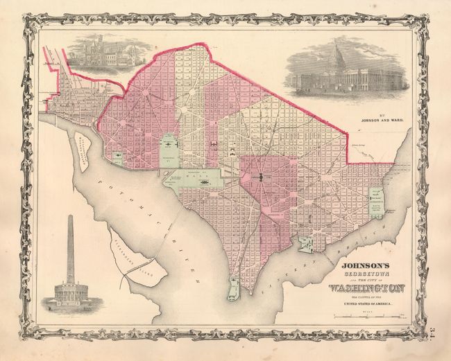
"[Lot of 2] City of Washington [and] Johnson's Georgetown and The City of Washington",

Subject: District of Columbia

Period: 1852-1863 (circa)

Publication:

Color: Hand Color

Size:
See Description
Download High Resolution Image
(or just click on image to launch the Zoom viewer)

The first city plan was published circa 1850 by Thomas, Cowperthwait & Co. in Mitchell's New Universal Atlas. (15.5 x 12.5") It is a detailed plan of the Capitol as it appeared in the early 1850's with an architectural plan of the principle floor of the Capitol building at upper right. Large References table locates 107 important buildings including embassies, churches, government and military facilities, galleries, breweries, etc. Surrounded by the signature banded border.

The second plan was published by Johnson & Ward in their Illustrated Family Atlas of the World, circa 1863. (15.4 x 12.3") This handsome plan includes three large engraved vignettes of The Capitol, Washington Monument, and Smithsonian Institution. All major streets and buildings are named. The map is surrounded with a decorative, metalwork border typical of the earlier Johnson maps.

References:

Condition: A

Both are very nice examples with full margins and fine, original color. The Cowperthwait map is actually fine (A+).

Estimate: $240 - $300

Sold for: $275

Closed on 9/1/2010

Archived