Catalog Archive
Auction 133, Lot 218

"Map of the City of La Mesa California and Vicinity",

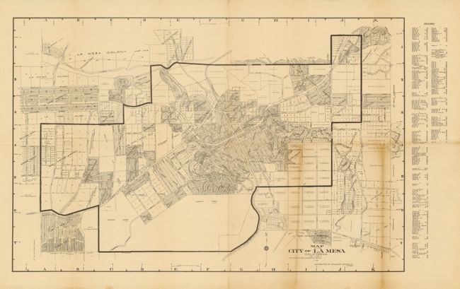
Subject: La Mesa, California

Period: 1928 (dated)

Publication:

Color: Black & White

Size:
21 x 13.5 inches
53.3 x 34.3 cm
Download High Resolution Image
(or just click on image to launch the Zoom viewer)

This uncommon town plan was created by the La Mesa Engineering Service and distributed by Engineers' Service Co., San Diego. Locates the subdivisions with each plat number listed. Shows all subdivisions including the La Mesa Colony, La Mesa County Club Tract, Murray Acres, Superior Heights, Sullivan Tract and many more. All streets and boulevards are delineated and named. Blank verso.

References:

Condition: B+

Very nice impression with original margins. Toned along two folds.

Estimate: $80 - $120

Sold for: $60

Closed on 9/1/2010

Archived