Catalog Archive
Auction 133, Lot 186

"Map of the United States and Their Territories Between the Mississippi and the Pacific Ocean and Part of Mexico Compiled from Surveys…", Emory, William Hemsley

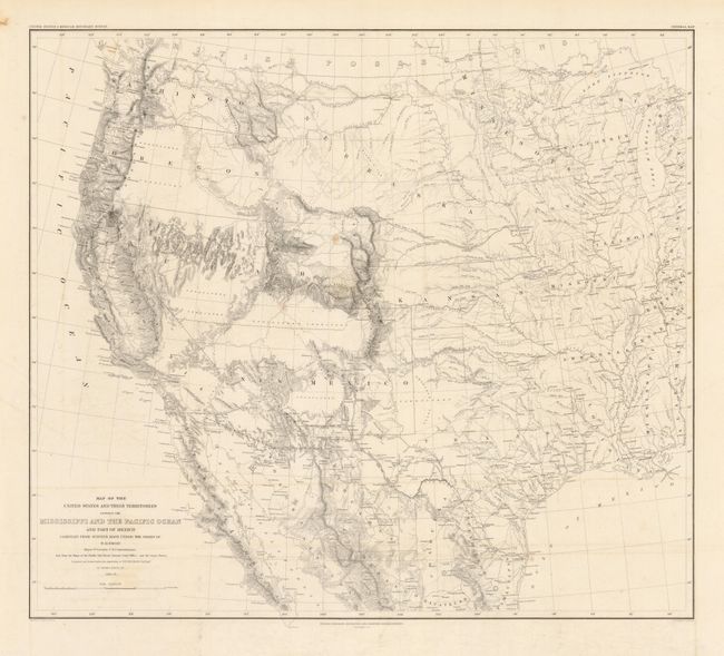
Subject: Western United States and Mexico

Period: 1857-8 (dated)

Publication: Mexican Boundary Survey

Color: Black & White

Size:
23 x 20.3 inches
58.4 x 51.6 cm
Download High Resolution Image
(or just click on image to launch the Zoom viewer)

This map is one of the foundation maps for the western United States and represents the culmination of fifty years of government explorations. Starting with Lewis and Clark, there were numerous official and unofficial surveys and explorations, all adding to the pool of knowledge presented here. While large sections are still labeled "unexplored territory," Emory fitted these fragments together with the information gathered during his surveys into a reasonably correct cartographic picture of the West. This map shows large, transitional territories of Nebraska, Kansas, New Mexico, Utah, Oregon, Washington and Minnesota. It was drawn by Thomas Jekyll under the supervision of Lt. Nathaniel Michler of the Topographical Engineers. Lt. Michler worked with his counterpart representing Mexico, Captain Francisco Jiménez, to survey between Nogales and Yuma including the area south of Arivaca.

References: Wheat (TMW) #916.

Condition: B+

Near fine example with just a couple spots and a portion of one fold with soiling at crease. Issued folding, now stored flat. Full margins.

Estimate: $375 - $450

Sold for: $275

Closed on 9/1/2010

Archived