Catalog Archive
Auction 133, Lot 136

"Etats-Unis de l'Amerique Seple avec le Canada et la Floride", Lattre, Jean

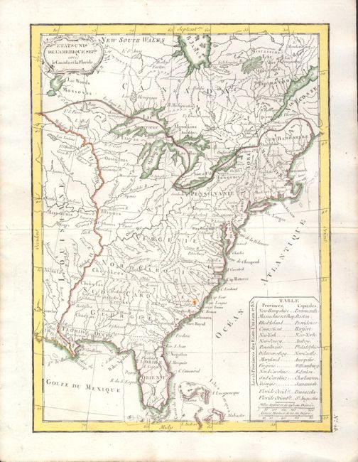
Subject: Eastern United States

Period: 1790 (circa)

Publication: Petit Atlas Modern

Color: Hand Color

Size:
7.3 x 9.8 inches
18.5 x 24.9 cm
Download High Resolution Image
(or just click on image to launch the Zoom viewer)

Attractive and early map of the United States that shows the western boundary of North and South Carolina, and Virginia and Georgia extending to the Mississippi River. A table in the Atlantic names the 13 states as organized in 1783 with their capitals. West and East Florida are delineated to show them as a part of the Spanish possessions of Louisiane with West Florida extending to the Mississippi River. The huge northwestern region is unnamed and unsettled. The map locates numerous forts, Indian villages and good detail of early watershed knowledge. Small decorative cartouche at upper left. No. 26 along vertical neatline at lower right.

References:

Condition: A

Map is fine with wide margins less one small rust spot in South Carolina.

Estimate: $200 - $240

Sold for: $150

Closed on 9/1/2010

Archived