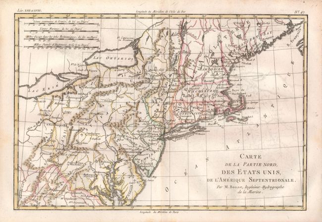
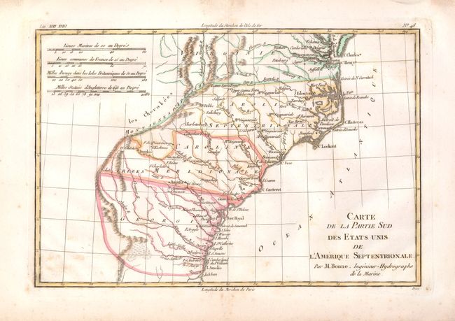
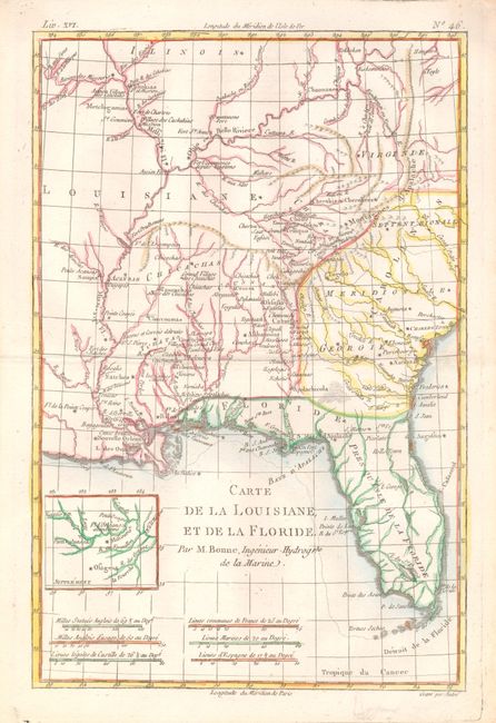
"[Lot of 3] Carte de la Partie Nord, des Etats Unis [and] Carte de la Partie Sud des Etats Unis [and] Carte de la Louisiane, et de la Floride", Bonne, Rigobert
1 of 3
Subject: Eastern United States
Period: 1783-85 (circa)
Publication: Raynal's Atlas de toutes les parties connues du Globe Terrestre…
1) Carte de la Partie Nord, des Etats Unis, de L'Amerique Septentrionale… covers the eastern seaboard from Maine (Machasuzet Bay) to Maryland and inland to Lake Erie and the Ohio River. Numerous settlements and forts are named, including in the western frontier Cumberland, Ft. Necessite, Fort Duquesne, Sandoske Ft., and many more. There is excellent detail of mountains and rivers. Very light toning along centerfold. (B+)
2) Carte de la Partie Sud des Etats Unis de L'Amerique Septentrionale covers the states of Virginia, North and South Carolina, and Georgia in the new United States. All settlement is confined east of the Appalachians with les Cherokees the only note in the otherwise blank region west of the mountains. Some light scattered foxing. Wide margins with deckle edge on two. (B+)
3) Carte de la Louisiane, et de la Floride covers the Southeast and the Mississippi River Valley and extends from Charleston, South Carolina west to include New Orleans and north into Illinois. The Mississippi and Ohio Rivers are finely described. Florida is shown with its panhandle extending west to include Mobile and Biloxi. A small inset provides details of the Missouri River. Engraved by Andre. Fine (A+).
References: 1) McCorkle #782.1A; Sellers & Van Ee #744. 2) Sellers & Van Ee #1406. 3) Sellers & Van Ee #1401.