Catalog Archive
Auction 133, Lot 132

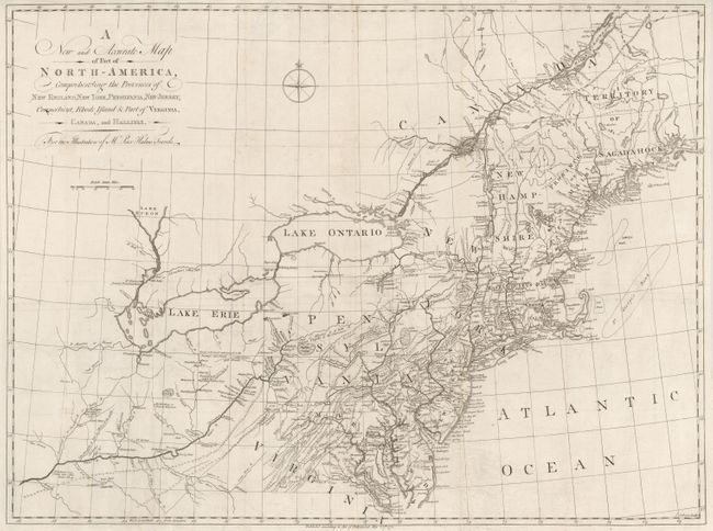
"A New and Accurate Map of Part of North America, Comprehending the Provinces of New England, New York, Pensilvania, New Yersey, Connecticut, Rhode Island, & part of Virginia, Canada, and Hallifax", Kalm, Peter

Subject: Colonial United States

Period: 1771 (dated)

Publication: Travels into North America …

Color: Black & White

Size:
30 x 22.3 inches
76.2 x 56.6 cm
Download High Resolution Image
(or just click on image to launch the Zoom viewer)

This scarce map covers Virginia through New England, the St. Lawrence River, Lake Ontario and Lake Erie and extends west to the confluence of the Ohio and Kentucky Rivers. The map is filled with detail of the colonies, as well as settlements, forts (including Fort Detroit), and Indian villages west of the Ohio River. There is great detail of the Swedish settlements, particularly along the Delaware River and in southern New Jersey. There are several interesting notations such as where to locate coal, salt and whet stones, and the place where elephant bones were found. Engraved by John Gibson and published to illustrate the English edition of Peter Kalm's book of his travels and adventures in the region. Kalm’s work is one of the most important and reliable eighteenth-century accounts of American natural history, social organization, and political situation. It also provides important accounts of the American Swedish settlements.

References: McCorkle #770.1; Seller & Van Ee #726.

Condition: B+

Issued folded. There are some old paper repairs on fold intersections and a few small worm tracks, else very good.

Estimate: $1,400 - $1,800

Unsold

Closed on 9/1/2010

Archived