Catalog Archive
Auction 133, Lot 131

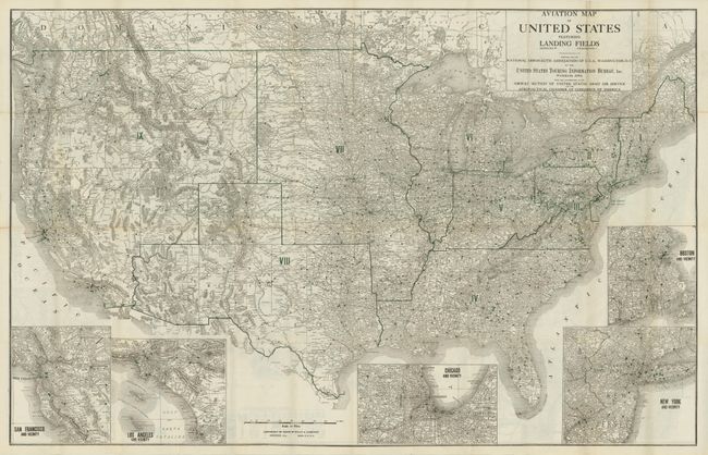
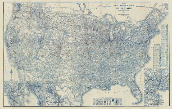
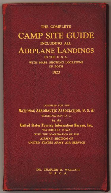
"Aviation Map of United States Featuring Landing Fields / Official Auto Trails Map of the United States [together with] The Complete Camp Site Guide…With Official Directory of Aeroplane Landing Fields", Rand McNally & Co.

Subject: United States

Period: 1923 (dated)

Publication:

Color: Printed Color

Size:
40.5 x 26 inches
102.9 x 66 cm
Download High Resolution Image
(or just click on image to launch the Zoom viewer)

This rare, early aviation map of the United States is the first edition, published in April 1923. We located only one other copy in the Library of Congress' collection. Akerman in Cartographics of Travel and Navigation (The Kenneth Nebenzahl, Jr., Lectures in the History of Cartography), p. 237, describes the map: "Using data collected by [U.S. Air Service] Rand, McNally published its first aviation map of the U.S. in April, 1923. More than 3,000 landing fields are shown by dot symbols…" Green overprinting is used to locate airports and to divide the states into nine districts as indicated in Roman Numerals, but there is no explanation of these regions. Five large inset maps illustrate major cities: San Francisco, Los Angeles, Chicago, New York, and Boston. The map was created by the United States Touring Information Bureau, Waterloo, Iowa with the cooperation of the Airway Section of the United States Army Air Service and the Aeronautical Chamber of Commerce of America. On the verso is the colorful U.S. Auto Trails Map with Tours and Camp Sites. This is the first aviation map produced by the Rand, McNally Company and is complete with its original Complete Camp Site Guide, which includes a pocket at the rear to store and protect the map. The 115 pp. guide lists all camp grounds and landing sites. Red leather with stamped gilt titling to cover.

References:

Condition: A

Leather cover is very nice with just a little rubbing to front spine top and bottom and corners. The map is near fine with a couple small fold intersection splits, impossible to avoid in a folding map of this size and period.

Estimate: $150 - $200

Sold for: $325

Closed on 9/1/2010

Archived