Catalog Archive
Auction 133, Lot 100

"Carte du Mexique et des Etats Unis d'Amerique, Partie Meridionale…", Delisle/Dezauche

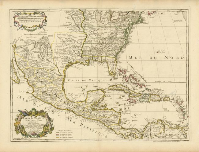
Subject: Colonial North America and Caribbean

Period: 1783 (dated)

Publication:

Color: Hand Color

Size:
25.7 x 18.8 inches
65.3 x 47.8 cm
Download High Resolution Image
(or just click on image to launch the Zoom viewer)

The title of this map contains a very early recognition of the newly formed United States, as 1783 is the earliest that the name appears on a printed map. This is the last issue of Delisle's map that was first issued in 1703 (Carte du Mexique et de la Floride). Delisle's map is regarded as the first map to accurately show the course of the Mississippi, accurately place the Great Lakes and locate many English coastal settlements. Its longevity and numerous copies by other mapmakers attest to the importance of this engraving. Dezauche was the son-in-law to Buache and the successor to the Delisle business. He altered the original title on the map to include the words Etats Unis. He also added a legend and color-coding to show the colonial possessions of England, France, Spain and the extent of the United States.

References: Tooley (Amer) p.22 #53; cf Cumming (SE) #137; Martin (TX) p.92-3.

Condition: A

There are some minor damp stains and a short fold separation in the blank margins. There is also a small stain in the Caribbean, still overall very good.

Estimate: $1,200 - $1,500

Unsold

Closed on 9/1/2010

Archived