Catalog Archive
Auction 132, Lot 70

"Der Neuen West Begriff Bestehende in 2 Haubt Theilen als Nord America und Sud America", Stridbeck, Johann

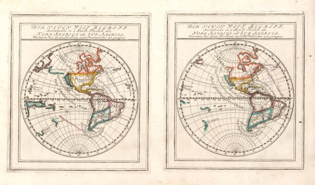
Subject: Western Hemisphere

Period: 1715 (circa)

Publication:

Color: Hand Color

Size:
11 x 5.8 inches
27.9 x 14.7 cm
Download High Resolution Image
(or just click on image to launch the Zoom viewer)

This interesting pair of maps, printed on a single sheet, show the differences between French and Dutch cartography of the Americas at the turn of the 17th century. At left is a map based primarily on Sanson. The island of California has an indented northern coastline. A coastline (Land von Jesso) nearly connects Asia and North America. In the South Pacific there is a fully formed New Guinee, part of Tasmania ( Diemens Land), the western coastline of New Zealand, and a partial coastline of the southern continent. In contrast, the map on the right is based on the work of Hondius and other Dutch cartographers. It shows the island of California with a flat northern coastline with the western coast of North America extending considerably above the island. The Land von Jesso appears as a very small landmass off Japan. In the South Pacific there is no hint of a southern continent and New Zealand is moved further west, pushing Tasmania and New Guinee off the map. The rivers systems in both North and South America differ as well. These maps are frequently found separated and having the pair intact is very desirable. McLaughlin mistakenly attributed the French version as a third state of the Dutch version.

References: McLaughlin #141.

Condition: A+

Original outline color with minor glue residue in left margin from binding.

Estimate: $400 - $500

Unsold

Closed on 6/2/2010

Archived