Catalog Archive
Auction 132, Lot 670

"Nieuwe Kaart van Caap der Goede Hoop…", Valentyn, Francois

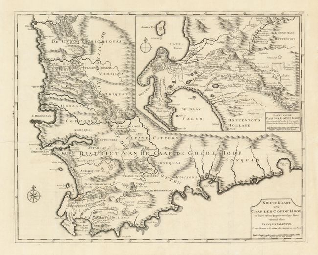
Subject: Africa - Southern

Period: 1726 (circa)

Publication: Oud en Nieuw Oost Indien

Color: Black & White

Size:
22.3 x 17.6 inches
56.6 x 44.7 cm
Download High Resolution Image
(or just click on image to launch the Zoom viewer)

This superb map of the Cape of Good Hope is one of the most important primary sources for information on the region. It was published in Francois Valentyn's immensely important history of the Dutch East Indies. Valentyn was a Minister of the Dutch Reformed Church who served with the Dutch East India Company. He obtained information for his map from the Dutch government at the Cape. The map covers the Western Cape and the Cape of Good Hope to just past Algoa Bay in the east. It is distinctively engraved to illustrate the settled areas, mountains and rivers with names of tribes and villages carefully noted. The large-scale inset of Cape Town and False Bay provides a wealth of information including the names and locations of individual farmers. It also shows roads and topography. This influential map was copied by several other cartographers throughout the 18th century.

References: Norwich #214.

Condition: A

Issued folded, now flattened with folds professionally reinforced on verso. A few worm holes in the top section have been expertly infilled (with the leaf-casting method) with a tiny bit of facsimile of the neatlines. The conservation was very skillfully accomplished and is now virtually invisible.

Estimate: $700 - $850

Sold for: $500

Closed on 6/2/2010

Archived