Catalog Archive
Auction 132, Lot 634

"[Japanese Travel Map]",
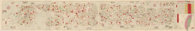
Subject: Japan

Period: 1895 (dated)

Publication:

Color: Hand Color

Size:
8.5 x 56 inches
21.6 x 142.2 cm
Download High Resolution Image
(or just click on image to launch the Zoom viewer)

This great woodblock print is a conceptual, stylistic map of Japan, produced during the Meiji period (1868 - 1912). The Meiji period is so named for the 45-year reign of Emperor Meiji and is the period associated with Japan's modernization and rise to world power status. The name literally means "Period of Enlightened Rule." The map, produced for the Japanese market, covers the whole of Japan, representing the country in a stylized fashion designed for the use of travelers going from town to town by way of roads and railroads. All names and descriptions are in Japanese characters. These travel maps were published as scrolls or folding as this example. The colorful map is printed from a woodblock on four joined rice paper segments that fold to approximately 5" x 7". At one end are panels of text and a woodblock image of a symbolic beast. Dainihon Meiken Douchu Ki created this Meiji 28 period (1895) map. It was published by Nakamura Senkichi.

References:

Condition: A+

Very nice example.

Estimate: $400 - $500

Sold for: $350

Closed on 6/2/2010

Archived