Catalog Archive
Auction 132, Lot 414

"Englalond Anglia Anglosaxonum Heptarchia Terra Armis Animisque Potens", Hole, William

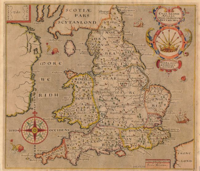
Subject: England & Wales

Period: 1610 (circa)

Publication: Camden's Britannia

Color: Hand Color

Size:
12.5 x 10.8 inches
31.8 x 27.4 cm
Download High Resolution Image
(or just click on image to launch the Zoom viewer)

Very graphic map of England and Wales depicting the traditional Anglo-Saxon kingdoms. This is the earliest obtainable map of England and Wales that is affordable for most collectors. First published in 1607 in the sixth edition of Camden's Britannia, the map is derived from William Rogers’ map of 1606. The place names have been transliterated into so-called Anglo-Saxon script, with a key at upper left that aids in the translation of letters. The large and ornate title cartouche features the seven-scepter symbol of the Heptarchy. The map is further decorated with a superb compass rose, two ships and three sea monsters. Blank verso.

References: Shirley (BI) #280; Moreland & Bannister p. 212.

Condition: B+

Evenly toned, else very good with supple paper.

Estimate: $350 - $425

Sold for: $250

Closed on 6/2/2010

Archived