Catalog Archive
Auction 132, Lot 321

"Texas, Mexico, and part of the United States. Compiled from the latest and best Authorities", Yeager, James

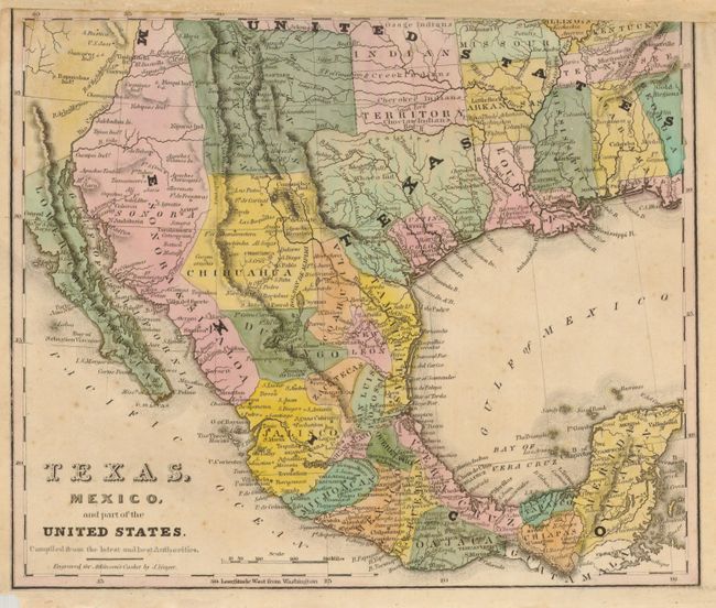
Subject: Southwestern United States, Texas and Mexico

Period: 1836 (published)

Publication: Atkinson's Casket

Color: Hand Color

Size:
10 x 8.3 inches
25.4 x 21.1 cm
Download High Resolution Image
(or just click on image to launch the Zoom viewer)

This rare map is one of the earliest maps to delineate the nascent Republic of Texas, here with Austin's and Dewitt's Colonies distinguished in pink. The southwestern border between Texas and Mexico follows the Nueces River which was later extended to the Rio Grande. Locates numerous Indian regions including the Whaco in Texas, Moqui, Navaho, several Apache tribes including the Mescalaros in Chihuahua in Mexico, and many more. In Texas the settlements of San Felipe, Matamoras, Brazaria and Victoria are located. An important map for any collection of Texas material.

References:

Condition: B

The map image is near fine, crisp and bright with strong hand coloring. Chip to lower left tip in blank margin. The top edge has been remargined to compensate for the binder's trim with complete loss of top neatline and some loss of inner ruled border and minor loss to map image at upper right.

Estimate: $1,000 - $1,500

Unsold

Closed on 6/2/2010

Archived