Catalog Archive
Auction 132, Lot 309

"South West-Virginia Mineral Resources & Railway Facilities", Boyd, C.R.
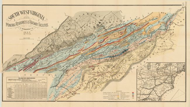
Subject: Virginia

Period: 1883 (dated)

Publication:

Color: Hand Color

Size:
38.5 x 20 inches
97.8 x 50.8 cm
Download High Resolution Image
(or just click on image to launch the Zoom viewer)

This is the scarce second edition of Boyd's colorful geological map of southwestern Virginia which also shows great detail of the railroads, topography via hachure, wagon roads, and the towns and villages in the state and part of northern Tennessee and the Allegany Mountains. The map identifies twelve different formations including zinc, copper veins, plaster and salt deposits, Oil-bearing series, Carboniferous, etc. This edition is centered on Marion and extends from the southwestern tip of Virginia eastward to Roanoke. His later maps would extend farther north up the Shenandoah Valley to Staunton. Boyd's series of important geological and mineralogical maps detailed this mineral-rich region and served as the basis for his promotion, together with Jed Hotchkiss, of the potential of the Virginia mineral belt during the mining boom of the late 19th century. The map names all railroads in the region as well as several mines including the Ore Knob, Clifton Copper & Silver, and the Peach Bottom Copper mines. Large inset at lower left shows the railway network in the eastern US and at left is a Table of Distances. Published in the Second Annual Report of the President and Directors of the Norfolk & Western Railroad Company to the Stockholders for the Year Ending December 31st, 1882.

References:

Condition: A

Bright original hand coloring and strong impression. Issued folding, now mostly flattened.

Estimate: $325 - $400

Sold for: $240

Closed on 6/2/2010

Archived