Catalog Archive
Auction 132, Lot 209

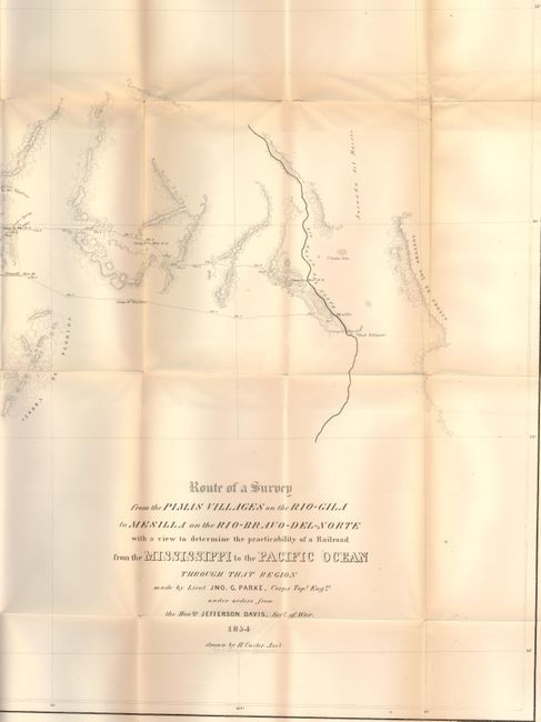
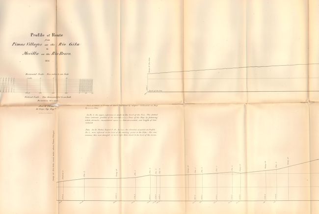
"[Lot of 2] Route of a Survey from the Pimas Villages on the Rio-Gila to Mesilla on the Rio-Bravo-del-Norte with a view to determine the practicability of a Railroad from the Mississippi to the Pacific Ocean…[with] Profile of Route from Pimas Villages…", Parke, John G. (Lt.)

Subject: Southwestern United States

Period: 1854 (dated)

Publication: U.S. Pacific Railroad Surveys

Color: Black & White

Size:
72 x 26 inches
182.9 x 66 cm
Download High Resolution Image
(or just click on image to launch the Zoom viewer)

This is a well-engraved map from the southern-most railroad surveys. This large map represents the first survey of the area that would become the Gadsden Purchase and is from the rare 8vo Pacific Railway atlas. Wheat states that the map also had "great meaning" when the Southern Pacific was built through the same area 30 years later. The map details the explorations and the proposed railroad route between El Paso and Phoenix. It delineates the watershed plus the topography through fine hachure. Filled with information including the naming of mountains and plains, shows location of gold placers, silver mines, water holes, springs and forts. Lt. J.G. Parke had the permission of the Mexican government to travel through their area. During the expedition he paid his respects to the Mexican governor in charge at Tucson. An early and historically important map of the Southwest that is on three joined sheets, as issued. The included Profile map measures 79 x 16" and is in similar condition.

References: Wheat (TMW) #851.

Condition: B

The map is on sound paper and carries a good impression. Toned along upper horizontal fold with several intersection splits, and with a few vertical folds at center also toned.

Estimate: $150 - $200

Sold for: $80

Closed on 6/2/2010

Archived