Catalog Archive
Auction 132, Lot 205

"Washington, Oregon, California, Utah, New Mexico", Smith, Roswell C.

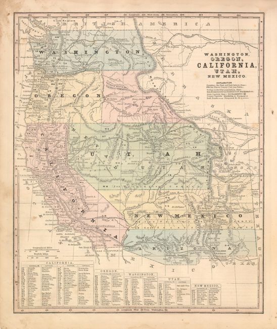
Subject: Western United States

Period: 1861 (circa)

Publication: Smith's Geography

Color: Hand Color

Size:
10 x 12 inches
25.4 x 30.5 cm
Download High Resolution Image
(or just click on image to launch the Zoom viewer)

This unassuming, Civil War period map includes several proposed western territories. The Confederate Territory of Arizona occupies the region to the south of New Mexico. This rarity existed for less than a year, from August 1861 until July of 1862, when Confederate General Baylor appointed himself the territorial governor and claimed all of New Mexico Territory south of the 34th Parallel. The Proposed Territory of Nevada is depicted in the western part of the large Utah Territory, the capital of which is Fillmore City. The Proposed Jefferson Territory is shown along the Front Range of the Rocky Mountains. This extralegal and unrecognized territory of the United States existed from October 24, 1859 until the creation of the Colorado Territory on February 28, 1861. St. Charles, the first name given for Denver, is located too far south just to the west of Pueblo. Washington Territory extends to the Continental Divide, and below it is the proposed region of Idaho or Shoshone. U.S. Mail routes and numerous proposed railroad routes are shown throughout the west including the first Transcontinental rail through Utah.

References:

Condition: B+

Fine impression with original color and margins. A little soiling or foxing in blank margins, map image is very good.

Estimate: $250 - $325

Sold for: $150

Closed on 6/2/2010

Archived