Catalog Archive
Auction 132, Lot 204

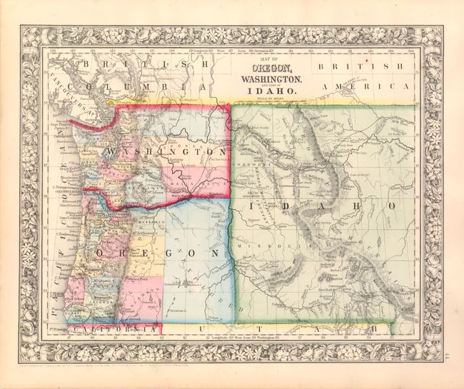
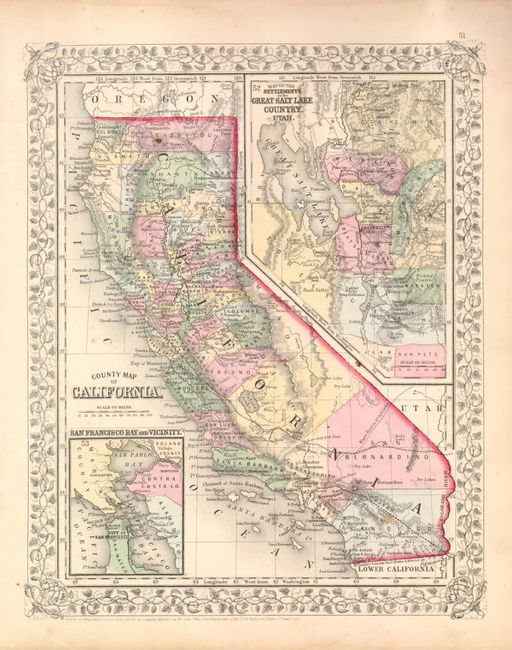
"[Lot of 2] Map of Oregon, Washington, and Part of Idaho [and] County Map of California", Mitchell, Samuel Augustus

Subject: Western United States

Period: 1860-66 (circa)

Publication:

Color: Hand Color

Size:
13 x 10.8 inches
33 x 27.4 cm
Download High Resolution Image
(or just click on image to launch the Zoom viewer)

1) Map of Oregon, Washington, and Part of Idaho. This decorative map shows transitional, territorial borders. It features the newly-formed huge territory of Idaho, here occupying present-day Montana and Wyoming. Eastern Washington is shown with only two named counties, Oregon has 19 of its 36 counties, and its eastern portion is noted only as unexplored. The map notes areas important to navigation on the Oregon Trail, such as Ft. Boisee [sic], Ft. Bonneville, the Three Buttes and several gold mining areas including Elk City, and much more. The Emigrant Route, winds across from South Pass, following the route of the Snake River and ending at Walla Walla.

2) County Map of California. This map is colored by county and provides a good view of the developing railroads, both completed and proposed. The Wagon Road to Gt. Salt Lake takes off out of San Bernardino County roughly along the same path as present-day Interstate 15. Utah is on the eastern boundary of California and the settlements of the Great Salt Lake form a large inset map taking in the region of present-day Nevada. The huge San Bernardino County extends from Utah Territory nearly to the Pacific Ocean at Los Angeles County. A smaller inset shows the vicinity of San Francisco Bay.

References:

Condition: A

There are a couple rust spots on the map of California, otherwise fine.

Estimate: $200 - $275

Sold for: $120

Closed on 6/2/2010

Archived