Catalog Archive
Auction 132, Lot 175

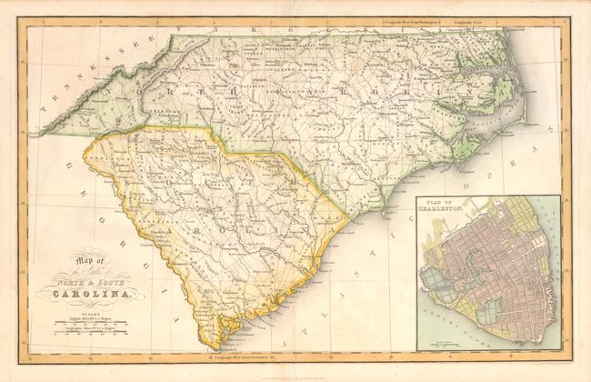
"Map of the States of North & South Carolina", Hinton, John
Subject: North and South Carolina

Period: 1832 (published)

Publication: History and Topography of the United States

Color: Hand Color

Size:
15.7 x 9.7 inches
39.9 x 24.6 cm
Download High Resolution Image
(or just click on image to launch the Zoom viewer)

This handsome map shows early county development with major towns, roads and rivers. There is very little topographical information provided other than the mountain ridges along the western boundary of North Carolina. A large plan of Charleston is inset at lower right.

References: Williams & Johnson, Tar Heel Maps, Fig. 20.

Condition: A

The bottom centerfold has been neatly repaired.

Estimate: $150 - $200

Sold for: $110

Closed on 6/2/2010

Archived