Catalog Archive
Auction 132, Lot 137

"Railroad Map of the United States", Warner & Beers

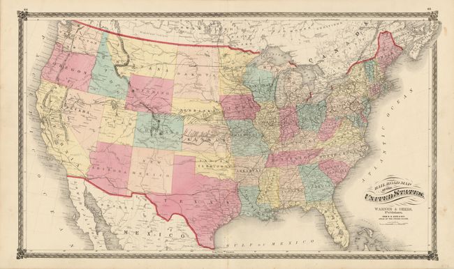
Subject: United States - Railroad

Period: 1874 (published)

Publication: Lloyd's Atlas of the United States

Color: Hand Color

Size:
28 x 16.5 inches
71.1 x 41.9 cm
Download High Resolution Image
(or just click on image to launch the Zoom viewer)

This is a very fine map showing the extent of the railroad network throughout the United States. The first transcontinental railroad had only been completed five years earlier with the joining of the Central Pacific and Union Pacific Railroads at Promontory Point, Utah. This railroad paved the way for western expansion that is illustrated here with several new spur lines already connecting the mining districts in Colorado and the agricultural and cattle regions in Nebraska and Kansas. The next transcontinental routes are shown with the northern route completed to Bismarck, North Dakota, and the southern route reaching Ft. Chadbourne, Texas. The western territories are still relatively undeveloped outside of a few forts and towns along the old wagon roads.

References:

Condition: A

Fine original color and condition with only a few insignificant spots in the blank margins and along the centerfold. The map is archivally encapsulated in a Mylar sleeve.

Estimate: $300 - $400

Sold for: $220

Closed on 6/2/2010

Archived