Catalog Archive
Auction 132, Lot 117

"Mappa dell'America Settentrionale ove sono rappresentati esattam, i Paesi e loro limiti controversi che hanno dato motiva…", Bellin, Jacques Nicolas

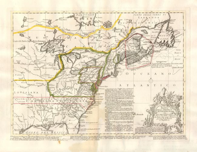
Subject: Colonial United States and Canada

Period: 1758 (published)

Publication: Descrizione Geografica di Parte dell'America Settentrionale

Color: Hand Color

Size:
15 x 10.6 inches
38.1 x 26.9 cm
Download High Resolution Image
(or just click on image to launch the Zoom viewer)

This is an unusual and very uncommon Italian map illustrating the French and English territorial claims on the eve of the French and Indian War. It is Bellin's version of Jean Palairet and Thomas Kitchen's important map of 1755 (McCorkle #755.22), which was in turn based on John Mitchell's index of his large, epic map of the region. The Great Lakes are beautifully illustrated with Lake Superior still sporting the imaginary island of Philippeaux. The map is filled with meticulously engraved detail of towns, forts, roads, and tribal lands. There are extensive notations providing historical information. It was published in Venice by P. Bassaglia.

References: McCorkle #758.1.

Condition: B

Original outline color with a light stain at bottom center.

Estimate: $600 - $700

Sold for: $350

Closed on 6/2/2010

Archived