Catalog Archive
Auction 130, Lot 95

"Religionis Catholicae in America Boreali Disseminatae Repraesentatio Geographica", Scherer, Heinrich

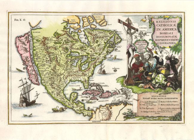
Subject: North America

Period: 1702 (circa)

Publication: Atlas Novus

Color: Hand Color

Size:
13.5 x 8.5 inches
34.3 x 21.6 cm
Download High Resolution Image
(or just click on image to launch the Zoom viewer)

This richly engraved map shows the island of California with an indented northern coast, interior mountains and no place names except S. Bruno on the southern tip of the island. Fretum Anian is placed to the northeast of California. The Mississippi River originates in present-day Canada and flows into the Sinus Mexicanus in present-day Texas. The Great Lakes are prominent, owing to the Jesuit sources of the map. The map is decorated with a pictorial title cartouche showing Jesus on the cross with the people of the world kneeling before him. A multitude of ships and sea monsters embellish the oceans. The chart at the bottom notes the locations of missions, both temporary and permanent. Henrich Scherer, a mathematics professor and Jesuit, produced this series of maps of North America to emphasize the extent of Catholic influence in the New World.

References: McLaughlin #121; Tooley (Amer) p. 132, #87.

Condition: A+

Estimate: $1,100 - $1,400

Sold for: $800

Closed on 12/2/2009

Archived