Catalog Archive
Auction 130, Lot 797

"Carte de la Baye de la Table et Rade du Cap de Bonne Esperance", Bellin/Van Schley

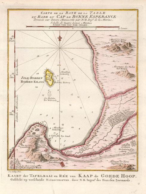
Subject: Southern Africa

Period: 1773 (published)

Publication: Raynal's Atlas Portatif

Color: Hand Color

Size:
6.5 x 8 inches
16.5 x 20.3 cm
Download High Resolution Image
(or just click on image to launch the Zoom viewer)

Great little map showing the Dutch settlement at Table Bay with Robben Island, Blue Mountains, Cow Mountains, the Gardens and Cultivated Land of the Company, Hottentot Village, the Mill, Fort and Batteries. Dutch title at bottom: Kaart der Tafelbaai en Ree van Kaap de Goede Hoop.

References: Tooley (MCC-6) #22.

Condition: A+

Original color with some minor printer's ink smudges in blank margins.

Estimate: $95 - $120

Sold for: $130

Closed on 12/2/2009

Archived