Catalog Archive
Auction 130, Lot 777

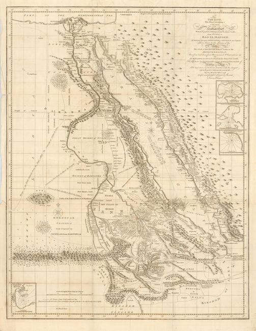
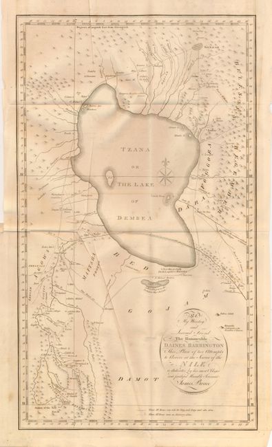
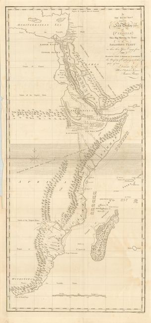
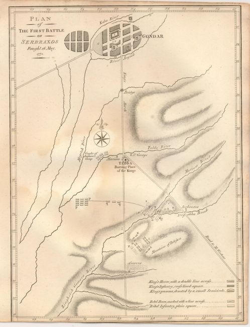
"[Lot of 3] … Chart of the Arabian Gulf with its Egyptian, Ethiopian and Arabian Coasts… [and] …Plan of Two Attempts to Arrive at the Source of the Nile… [and] …Map Showing the Tract of Solomon's Fleet… [with grouping of prints]", Bruce, James

Subject: Egypt

Period: 1813 (published)

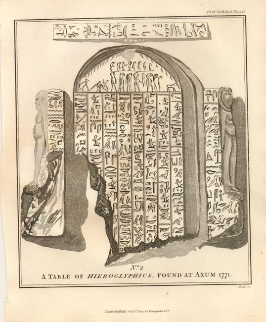
Publication: Travels to Discover the Source of the Nile in the Years 1768, 1769, 1770, 1771..

Color: Black & White

Size:
9 x 11.5 inches
22.9 x 29.2 cm
Download High Resolution Image
(or just click on image to launch the Zoom viewer)

1) 19.5 x 25" Fascinating and intricately detailed map of the Red Sea and Nile valley. In 1768 Bruce traveled down the Red Sea as far as the straits of Bab el Mandeb and then struck inland for Gondar, the capital of Ethiopia. He rediscovered the source of the Blue Nile, which he followed to its confluence with the White Nile. Four small insets detail the harbors of Rarac, Ibraim, Sert, and Masuah. Some historical researchers believe that much of the motivation behind Bruce's epic travels in Ethiopia centered around his desire to recover sacred objects connected with Solomon's Temple and in verifying legends associating the medieval Knights Templar with old Christian churches in Ethiopia. A little light scattered toning or staining. Long tear at binding trim expertly closed on verso. Folded as issued.

2) 11.8 x 20.3" Map "reconstructs" the route of King Solomon's legendary expedition along the East African coast in search of mineral wealth. Extends from the Mediterranean Sea at Egypt to the Cape of Good Hope. Locates Madagascar, Gold Mines and Silver Mines just south of the "Limits of the Tropical Rains," Monsoon wind flows, The Great Desert of Numbia, and much more. Light toning or staining in lower and upper right. Tear at binding trim expertly closed on verso. Folded as issued. (B+) 3) Map of Lake Tana, the source of the Blue Nile as confirmed by Bruce in 1772, 12 x 26.8". Delineates the King's Retreat and Bruce's travels. Locates Gondar and many other small villages, mountains, cataracts, and wells. The source of the Nile is noted at lower left. Some light scattered staining or foxing. Folded as issued. (B+)

James Bruce was one of the earliest westerners to search for the source of the Nile. His publication greatly enhanced European's knowledge of the geography and ethnography of this portion Africa and Egypt. Bruce believed the Blue Nile, although smaller than the White Nile, was the Nile of the ancients and focused his explorations on this river. In November of 1770 he reached the source of the Blue Nile and claimed to have discovered its source. These maps and few engravings are from the five volume account of his travels published from London in 1790, twelve years after his journey ended.

Plus five full page maps, including: 1) Plan of Island and Harbour of Masuah; Plan of the First Battle of Serbraxos Fought 16 May, 1772; 2) Plan of the Second Battle of Serbraxos Fought 20 May, 1772; 3) Plan of the Third Battle of Serbraxos Fought 23d May, 1772; and 4) [untitled map of the African continent] with little detail other than naming the major areas. Finally, the lot includes the following full page engraved and aquatint plates: Plate 1 [Portrait of] James Bruce of Kinnaird, Esq.; Canja under Sail; Section of the Canja; Obelisk at Axum; No. 1 A Table of Hieroglyphics, found at Axum 1771; No. 2 A Table of Hieroglyphics, found at Axum 1771; Kefla Abay, High Priest of the Nile; Woodage Asahel [and] Abyssinian Lady of Quality (two portraits in oval frames); Papyrus; Abrab of Loheia, Tribe Beni Koreish; Arab Shekh, Bribe Beni Koreish; Mikeas; untitled plate of weapons - javelins, silver disc, shields, flags, etc; Painting in Fresco, in the Sepulchers of Thebes; Painting in Fresco, in the Sepulchers of Thebes (different image); Ozoro Esther [and] Tecla Mariam [and] Kefla Yasous (three portraits in oval frames); and three plates of the Ethiopic and Amharic alphabet and Specimens of the Abyssinima Languages. This collection includes the title page for this third edition atlas volume with an old library stamp "Library of the Medical Department of the Army." All of these plates vary in condition from good (B) to very good (A).

References:

Condition:

See description.

Estimate: $800 - $1,000

Sold for: $425

Closed on 12/2/2009

Archived