Catalog Archive
Auction 130, Lot 434

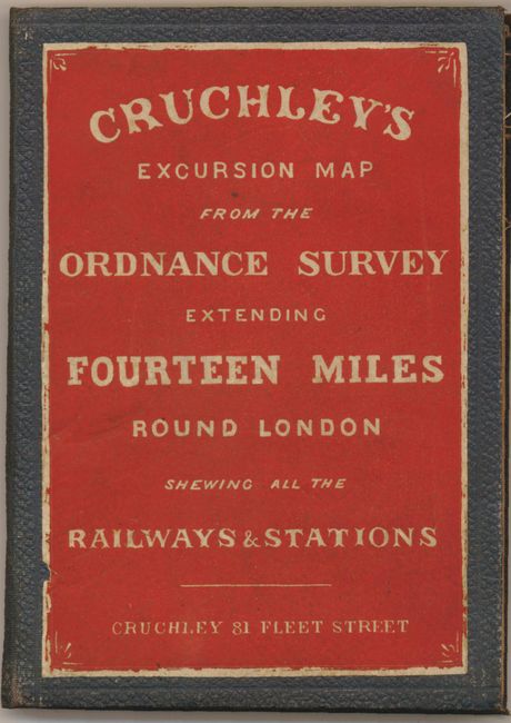
"Ordnance Map of the Country Round London", Cruchley, George Frederick

Subject: London, England

Period: 1860 (circa)

Publication:

Color: Hand Color

Size:
28 x 23 inches
71.1 x 58.4 cm
Download High Resolution Image
(or just click on image to launch the Zoom viewer)

This is an extremely detailed folding pocket map based on the famous Ordnance Survey maps. It is centered on London and showing the vicinity to covers from Watford in the northwest to Walton-on-Thames to the southwest, Eynesford and Farningham to the southeast and Stapleford Abbots in the northeast. The map contains a remarkable amount of detail including major streets, prominent buildings and features, adjoining towns and villages with connecting roads, railroads and stations, and more. Color is used to delineate parks, rail stations, cemeteries, and political divisions. The railroads are particularly prominent as a great many radiate in all directions from London. This edition is segmented and mounted on its original linen. Folds into original blue cloth boards with large paper title label in orange. Title on the cover is Cruchley's Excursion Map from the Ordnance Survey Extending Fourteen Miles Round London Shewing all the Railways & Stations, Cruchley 81 Fleet Street. The map has a marbled paper label on one panel making an additional cover when folded. Inside paper label in yellow advertises other maps for sale by Cruchley. George Frederick Cruchley (1787-1880) was trained by Aaron Arrowsmith and obviously continues his accurate and precise style.

References:

Condition: A

A beautiful example with bright color, sound paper and linen. A couple small spots in exposed linen near Stanmore otherwise fine. Cover and paper label with just the slightest rubbing.

Estimate: $200 - $300

Sold for: $150

Closed on 12/2/2009

Archived