Catalog Archive
Auction 130, Lot 36

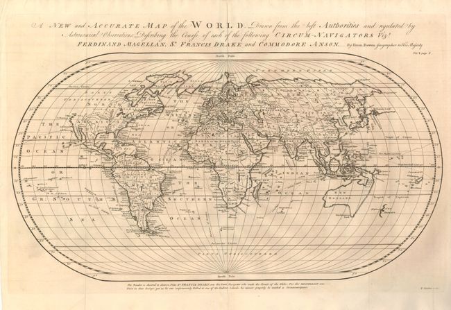
"A New and Accurate Map of the World. Drawn from the Best Authorities and Regulated by Astronomical Observations: Describing the Course of Each of the Following Circum-Navigators vizt. Ferdinand Magellan, Sr. Francis Drake and Commodore Anson", Bowen, Emanuel

Subject: World

Period: 1764 (circa)

Publication: John Harris' Navigantium atque Intinerantium…

Color: Black & White

Size:
21.5 x 11.5 inches
54.6 x 29.2 cm
Download High Resolution Image
(or just click on image to launch the Zoom viewer)

Handsome world map on an oval projection depicting the tracks of Magellan, Drake and Anson. The northwestern part of North America is labeled Parts Undiscovered. Australia, Tasmania and New Guinea are all connected by dotted lines forming a conjectural shape for New Holland. De Gama's Land lies to the east of Japan. A notation printed below the map shows the political bias of the mapmaker - "The Reader is desired to observe, that Sr. Francis Drake was the first navigator who made the Circuit of the Globe: For tho' Magellan was First in that Design, yet as he was unfortunately killed at one of the Ladrone Islands, he cannot properly be intitled [sic] a Circumnavigator." The map was engraved by Thomas Kitchin.

References:

Condition: A

Issued folded, now flattened with a couple of marginal fold separations closed with archival tape on verso.

Estimate: $600 - $700

Sold for: $475

Closed on 12/2/2009

Archived