Catalog Archive
Auction 130, Lot 338

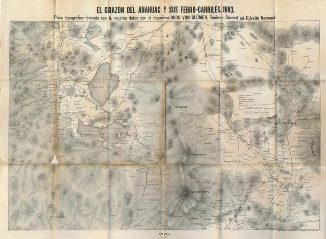
"El Corazon del Anahuac y sus Ferro-Carriles",

Subject: Mexico

Period: 1883 (dated)

Publication:

Color: Black & White

Size:
22.5 x 15.3 inches
57.2 x 38.9 cm
Download High Resolution Image
(or just click on image to launch the Zoom viewer)

This uncommon Mexican produced map was created by Engineer Bodo von Glumer "Teniente Coronel Ejercito Nacional." The map focuses on the Mexico [City] vicinity at left and Tlaxcala and Puebla to the east. Highly detailed topographical map designed to show all railroads in the region. The legend locates town and villages, pueblos, ranches, national railways, railroads under construction and the rivers. Locates Cholula, S. Martin Texmelucan, Calpulalpam, Cuautitlan and names the huge mountains in the region. Lithography by Major & Knapp of New York. Folds into green cloth covers with gilt stamped title. The map was pasted into covers upside down. A most uncommon issue.

References:

Condition: B

With loss at one fold intersection and a little toning along the same fold with some creasing and a split.

Estimate: $100 - $200

Unsold

Closed on 12/2/2009

Archived