Catalog Archive
Auction 130, Lot 320

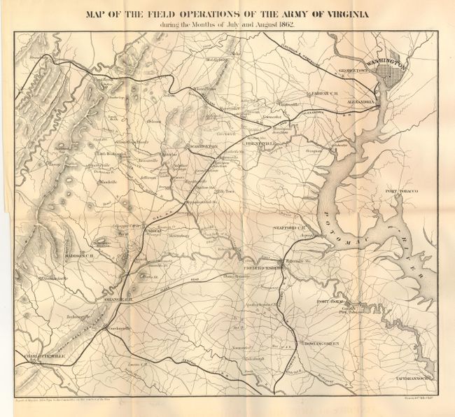
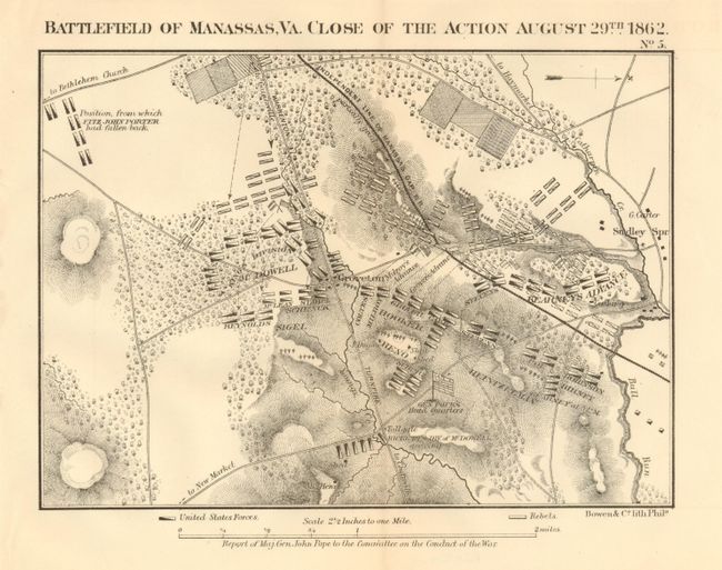
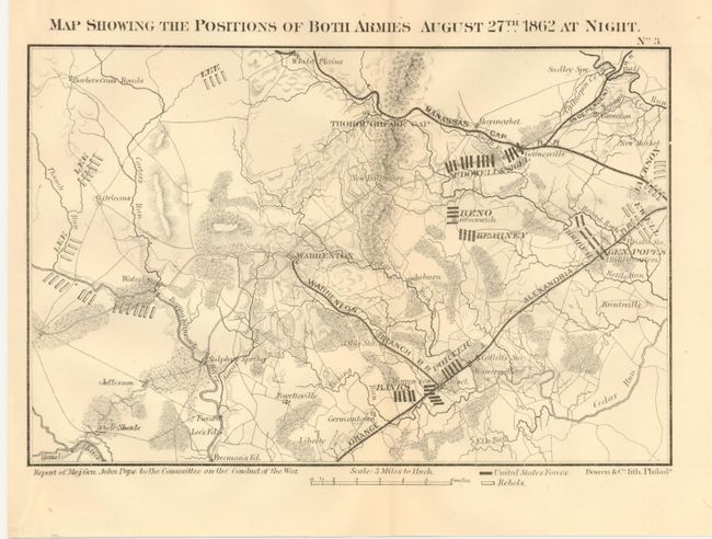
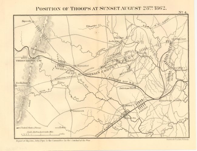
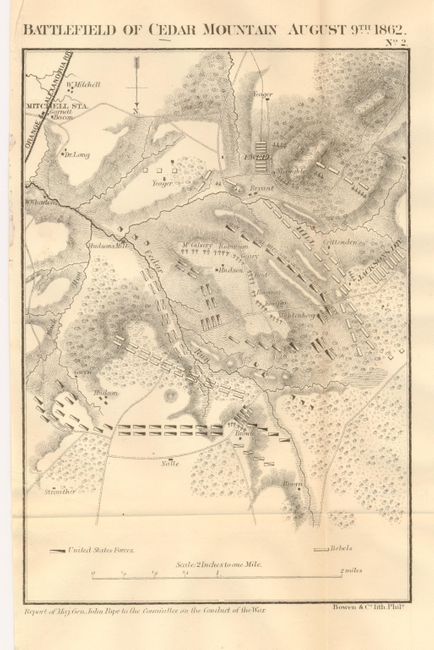
"[Lot of 5 - Virginia, Civil War]", Bowen & Co., John T.

Subject: Virginia, Civil War

Period: 1862 (dated)

Publication: Pope's Report to the Committee on the Conduct of the War

Color: Black & White

Size:
See Description
Download High Resolution Image
(or just click on image to launch the Zoom viewer)

A fascinating set of Civil War battle maps produced by Maj. Gen. John Pope for his contribution to the 1863 report to Congress's Joint Committee of the War Department. The lot includes the following maps:

1) Map of the Field Operations of the Army of Virginia During the Months of July and August 1862 (16.5 x 14.3"). The largest map in the set, it shows the area from Charlottesville to Washington DC. Binding tear in left margin repaired with archival tape on verso.

2) Battle of Manassas, Va. Close of the Action August 29th 1862 (8.8 x 6.3"). Good topographical detail with forests, creeks and some farmland.

3) Map Showing the Positions of Both Armies August 27th 1862 at Night (9 x 5.8"). Locates Gen. Pope's Headquarters and the position of Gen. Lee's troops. Clean example with a minor extraneous crease.

4) Position of Troops at Sunset August 28th 1862 (8.8 x 6.2"). Shows the tremendous troop movement from the previous day shown in map #3.

5) Battlefield of Cedar Mountain August 9th 1862 (6.1 x 8.8"). Shows the positions of Ewell, Hill and Jackson's Divisions.

References: Stephenson (CW) #465.67; 573.5; 573.7; 573.5; 526.5.

Condition: A+

Each is folding as issued and fine.

Estimate: $180 - $220

Sold for: $100

Closed on 12/2/2009

Archived