Catalog Archive
Auction 130, Lot 301

"Plan of Fort du Quesne before it was Destroyed", Anon.

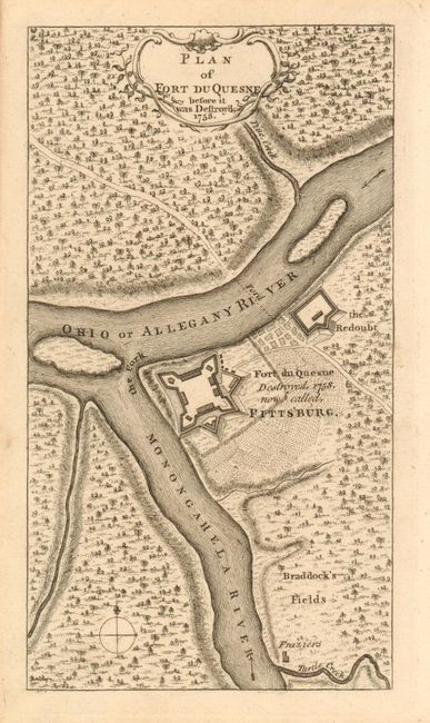
Subject: Pennsylvania

Period: 1758 (dated)

Publication: Grand Magazine of Magazines

Color: Black & White

Size:
4.1 x 7.3 inches
10.4 x 18.5 cm
Download High Resolution Image
(or just click on image to launch the Zoom viewer)

This scarce little map shows Fort Duquesne at the fork of the Ohio and Monongahela Rivers, noted as being destroyed in 1758 and "now called Pittsburg." Locates Braddock's Fields, site of the infamous defeat of General Braddock at the hands of the French and Indians. Also names Turtle Creek, Pine Creek, the farm of the Fraziers and the forts Redoubt. The surrounding country is fully engraved to suggest forest. The Grand Magazine of Magazines was a short-lived publication issued between July 1758 and December 1759.

The January 1759 map "Fort du Quesne, Now Pittsburgh, and its environs" published in the Scots Magazine has been called the "first map of Pittsburgh." General Forbes' army seized control of the fort and surrounding vicinity and renamed it "Pittsburg" in November, 1758. This map pre-dates the Scots issue by a month suggesting this map is actually the first to name Pittsburgh. A desirable and scarce map from this rarely seen publication.

References: Jolly GMOM-17.

Condition: A+

Pin hole in blank right margin.

Estimate: $600 - $800

Sold for: $600

Closed on 12/2/2009

Archived