Catalog Archive
Auction 130, Lot 291

"A Plan of the City and Environs of New York in North America", Anon.

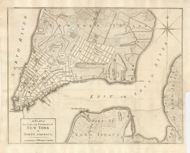
Subject: New York City

Period: 1776 (published)

Publication: Universal Magazine,

Color: Black & White

Size:
14.5 x 11.3 inches
36.8 x 28.7 cm
Download High Resolution Image
(or just click on image to launch the Zoom viewer)

This uncommon, Revolutionary War era map was published in November 1776 to inform the British public of the growing conflict. The cartography is a compilation of the Montresor (1766) and Ratzen (1767) maps, but with some new additions and details, including the addition of the name Delaney's New Square to an area near the Collect Pond (labeled here Fresh Water) that is surrounded by blocks of New Buildings not Finished. The square is shown on the Ratzen map as the Great Square, and by the 1780s it is filled with buildings. The map names many streets and roads, including Broadway and the Road to King's Bridge where the Rebels mean to make a Stand, which runs parallel to Road to Kepps Bay where the Kings Troops Landed. It also includes details of wharves, ferries, public buildings, some industries, orchards, gardens, fields, houses (including some resident's names), Fort George, and the battery.

References: Jolly UNIV-177; Nebenzahl (Biblio) #114; Sellers & Van Ee #1110.

Condition: B+

Issued folded, now flattened with one fold intersection professionally repaired. There is a normal binding trim at lower right with a repaired binding tear that just touched the neatline. There is some minor offsetting.

Estimate: $1,500 - $1,800

Sold for: $1,200

Closed on 12/2/2009

Archived