Catalog Archive
Auction 130, Lot 270

"Plan of New Orleans the Capital of Louisiana", Benning, Robert

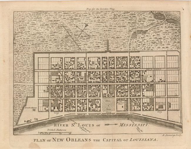
Subject: New Orleans, Louisiana

Period: 1761 (published)

Publication: London Magazine

Color: Black & White

Size:
9 x 7.2 inches
22.9 x 18.3 cm
Download High Resolution Image
(or just click on image to launch the Zoom viewer)

Great little plan detailing the city center, including Bourbon Street, with the roads leading into the city. It shows houses, streets, the Parish Church, municipal buildings, barracks, a powder magazine, a brick kiln, and the New House of ye Ursalines (Ursuline Academy), among its many details. Based on a manuscript map by Le Blond de la Tour that formed the basis of most plans of New Orleans throughout the 18th century. This is one of the earliest available plans printed in English; the first being Thomas Jefferys' plan of 1759.

References: Jolly LOND-199; Sellers and Van Ee #1679.

Condition: B+

There is a small stain near title at bottom, else very good.

Estimate: $300 - $375

Unsold

Closed on 12/2/2009

Archived