Catalog Archive
Auction 130, Lot 212

"Countries Bordering on the Mississippi and Missouri", Schoolcraft, H.

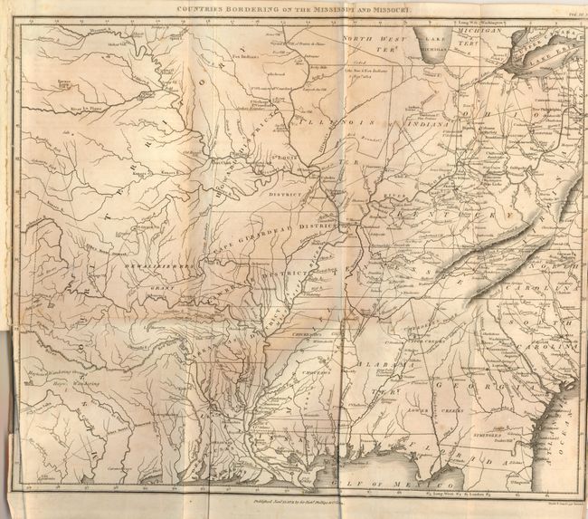
Subject: Central United States

Period: 1821 (published)

Publication: Journal of a Tour into the Interior of Missouri and Arkansaw… 1818 and 1819

Color: Black & White

Size:
14.5 x 12 inches
36.8 x 30.5 cm
Download High Resolution Image
(or just click on image to launch the Zoom viewer)

This rarity is an early map detailing the heart of the United States, from the region of present-day North Dakota to Lake Erie in the north, and from San Antonio to the Georgia and Florida coast in the south. The boundaries and internal political divisions of Arkansas and Missouri are unique to this map. Their western boundary is defined by the "Osage Boundary" shown at 94°W longitude. Arkansas contains two districts, namely Arkansas and Lawrence, and Missouri contains Cape Girardeau, St. Louis and Howard districts. To the west is an immense Missouri Territory which in turn incorporates a large but ill-defined Dewalieierres Grant with no mention of Texas or Cenis. Chicago is on the shore of Lake Michigan in Illinois Territory, but is shown many miles south of its correct position. The "Extended [Indian] Boundary by various Treaties" wanders through Indiana and Ohio and is loosely associated with the north-south Osage Boundary. In the area of Texas, the outward and homeward routes for Pike's expedition are delineated, many forts are named, and the Haywa Wanderings and the Haytones Wandering Grounds are located. Early wagon roads and trails noted, as are early towns and cities as far north as Cleveland. Imprint below neatline "Published Jany. 15, 1821 by Sir Richd. Phillips & Co. London." The map is bound it the original "Journal of a Tour into the Interior of Missouri and Arkansas, from Potosi, or Mine a Burton, in Missouri Territory, in a South-West Direction, toward the Rocky Mountains; Performed in the years 1818 and 1819" by Henry R. Schoolcraft, Printed for Sir Richard Phillips and Co., London. This is Schoolcraft's log detailing his remarkable 90-day expedition. Without covers, 102 pp, large folding engraved map present.

References: Wagner & Camp #21.

Condition: B+

The map has a little light scattered foxing or offsetting. The book is generally clean but some pages have a little text browning and the title page has some foxing.

Estimate: $600 - $700

Sold for: $550

Closed on 12/2/2009

Archived