Catalog Archive
Auction 130, Lot 148

"The United States of America with the British Possessions of Canada, Nova Scotia, New Brunswick and New Foundland", Laurie & Whittle

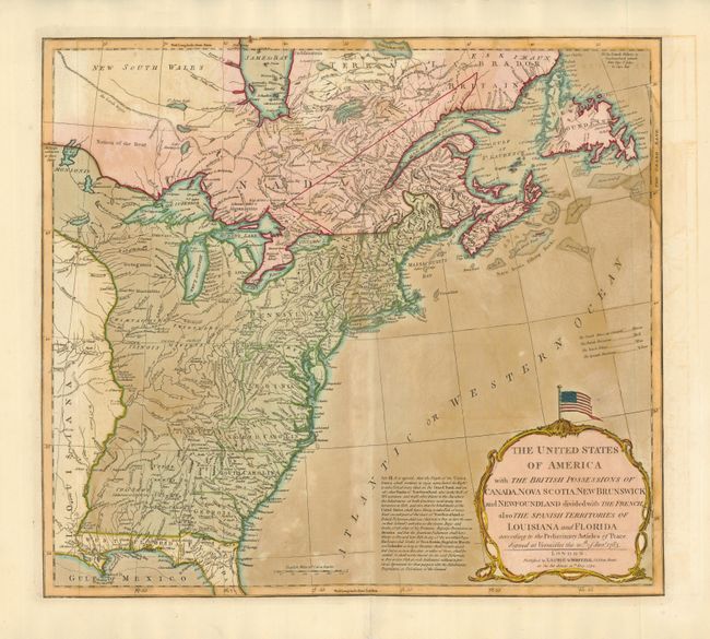
Subject: United States and Canada

Period: 1794 (dated)

Publication:

Color: Hand Color

Size:
20 x 18 inches
50.8 x 45.7 cm
Download High Resolution Image
(or just click on image to launch the Zoom viewer)

This map had a long publication history. It was prepared by Thomas Jefferys and first published in 1755, with the title North America from the French of Mr. D'Anville…, to illustrate the French and Indian War. In this fourth and final state, published by Laurie & Whittle, it illustrates the infant United States. New England is shown extending well into New Brunswick, and there are several changes in the shoal areas of the Gulf of Maine and the important nearby fishing banks. The map is extremely detailed with the locations of forts, Indian villages, tribal territory, and mines. West and East Florida are Spanish possessions. The large, decorative title cartouche is surmounted by a Stars and Stripes flag. The text of Article III of the Treaty of Paris is printed to the left of the cartouche, referring to the fishing rights of the United States.

References: McCorkle #755.2.

Condition: B

Original color with some uneven toning. There is a small puncture in the bottom blank margin, well away from the map.

Estimate: $1,100 - $1,300

Sold for: $800

Closed on 12/2/2009

Archived