Catalog Archive
Auction 129, Lot 803

"Africae Tabula Nova", Ortelius, Abraham
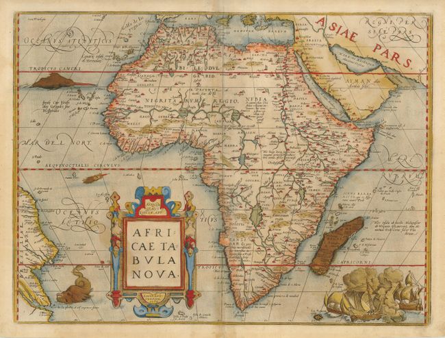
Subject: Africa

Period: 1570 (dated)

Publication: Theatrum Orbis Terrarum

Color: Hand Color

Size:
19.7 x 14.7 inches
50 x 37.3 cm
Download High Resolution Image
(or just click on image to launch the Zoom viewer)

This striking map is one of the cornerstone maps of Africa and remained the standard map of Africa well into the seventeenth century. It was designed by Ortelius from elements of contemporary maps by Gastaldi, Mercator, and Forlani and used several recent sources: Ramusio in Navigationi et Viaggi (1550), Joao de Barros in Decadas da Asia (1552), and Leo Africanus in Historiale description de l'Afrique (1556). The majority of the nomenclature is taken from Gastaldi. The Nile is based on the Ptolemaic concept, originating from two large lakes south of the equator. Curiously Ortelius did not represent the Mountains of the Moon (a prominent feature on most prior maps) and the twin lakes are not named. Ortelius introduced two important changes to the shape of the continent on this map; the Cape of Good Hope is more pointed, and the eastward extension of the continent was reduced significantly. The map is decorated with a strap work title cartouche, a grand sea battle (copied from Diego Gutierez' wall map of the Americas), and sea monsters. A ghostly image of a sea monster off the Arabian Peninsula is visible, which is only seen on early impressions. This beautiful map was engraved by Frans Hogenberg who engraved many of the maps for the Theatrum. This is from an early Latin edition with Latin text on verso.

References: Betz #12.2; Van de Broecke #8; Norwich #10 :Tooley (AF) p. 88.

Condition: B

There is some toning and the old color has oxidized but the paper is not brittle. The centerfold has been repaired and reinforced with Japanese tissue.

Estimate: $2,000 - $2,400

Sold for: $1,500

Closed on 9/23/2009

Archived