Catalog Archive
Auction 129, Lot 750

"A New Mapp of Asia Divided into Kingdoms & Provinces…", Lea & Overton
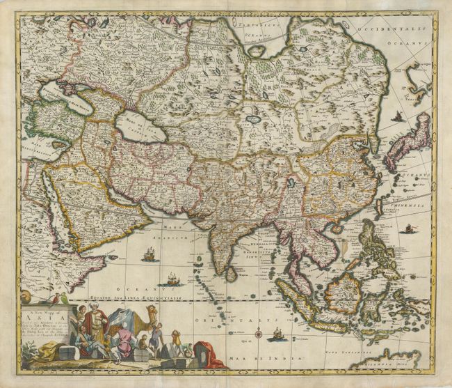
Subject: Asia

Period: 1690 (circa)

Publication:

Color: Hand Color

Size:
21.8 x 18.8 inches
55.4 x 47.8 cm
Download High Resolution Image
(or just click on image to launch the Zoom viewer)

This is a very uncommon map of the continent based on the popular map of Frederick de Wit. It is vividly rendered with good detail throughout the south and southeast reflecting the surveys of the Dutch East India Company, while northern and central Asia is filled mostly with mountains, deserts and forests and the northeast coastline is severely truncated. A detached coastline of Yedso appears to the north of Japan. The work of the Jesuit missionaries is reflected in the well-documented region of China. The title cartouche was also copied from De Wit and features a busy scene including traders with their exotic cargo. This is the second state with Philip Lea's address at ye Atlas and Hercules in Cheapside.

References:

Condition: B

Several edge tears are repaired with tissue, one of which entered 1" into the cartouche, and a fold separation at bottom is also repaired.

Estimate: $900 - $1,100

Sold for: $650

Closed on 9/23/2009

Archived