Catalog Archive
Auction 129, Lot 693

"Niew en seer Nawkeurig Corecte Plan van Gibraltar met alle syne Fortificatiens en Verbeteringe en de Nuttigheeden van dien Plaats…", Leth, Andries & Hendrik de

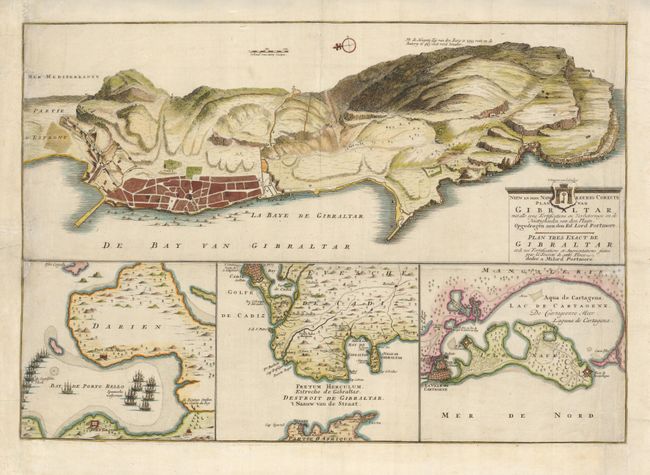
Subject: Gibraltar, Panama, Colombia

Period: 1745 (circa)

Publication:

Color: Hand Color

Size:
22.8 x 15.5 inches
57.9 x 39.4 cm
Download High Resolution Image
(or just click on image to launch the Zoom viewer)

At the conclusion of the War of the Spanish Succession, the Treaty of Utrecht in 1713 granted Britain possession of the stronghold of Gibraltar and a thirty-year contract-right to supply slaves and goods to the Spanish colonies. Tensions between the two powers continued and Britain and Spain continued to wage war with one another; the War of the Quadruple Alliance (1718-20), the Blockade of Porto Bello (1726), the Anglo-Spanish War (1727-29), and the War of Jenkin's Ear (1739-48). This rare map provides detailed views of the regions embroiled in these conflicts. At top is a map of the fortress of Gibraltar. The map is dedicated to Sir David Colyear, first Earl of Portmore who commanded the English defense force during the Spanish siege of 1727. At bottom are maps of the strategic Strait of Gibraltar. On the left is a plan of the Bay of Porto Bello, a silver-exporting town on the coast of Panama, that was captured by the British in 1739. And to the right a plan of Cartagena, one of Spain's principal gold-trading ports in their colony of New Granada (present-day Colombia), which was the scene of an attack launched by the British under Admiral Edward Vernon in 1741.

References:

Condition: C+

The map is remargined on three sides with a small loss of neatlines at left replaced in facsimile. There is a 1" repaired tear in the upper left side.

Estimate: $500 - $600

Unsold

Closed on 9/23/2009

Archived