Catalog Archive
Auction 129, Lot 657

"Plan de l'Fortee de Chalcis [manuscript map]",
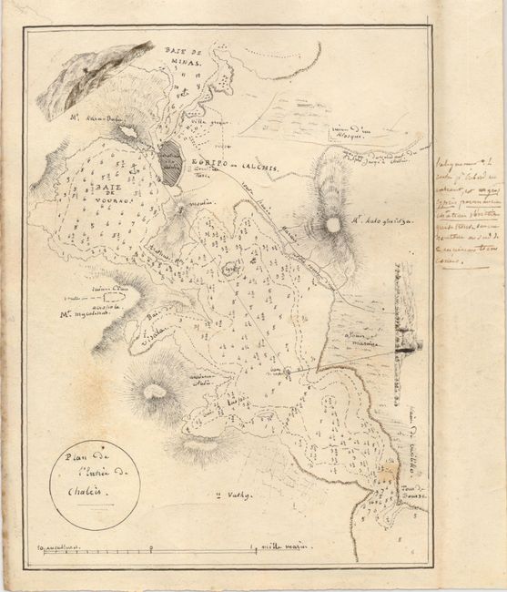
Subject: Greece

Period: 1800 (circa)

Publication:

Color: Black & White

Size:
5.8 x 7.5 inches
14.7 x 19.1 cm
Download High Resolution Image
(or just click on image to launch the Zoom viewer)

This is a beautifully and precisely drawn manuscript map of the area around Chalcis (Khalkis), Greece with the fortified town the most prominent feature. The map locates Mt. Kara-Baba with adjacent view of the mountain and a fortress at its top. Another view at the right also has at its top a tower or fortress. There are numerous places names and roads in the area: Baie de Minas, Mt. Kaloghritza and a few more. The bay is filled with soundings. Title is in a circular cartouche and the distance scale exemplifies the care taken in this design. Khalkis was a trade crossroad for centuries. An interesting fact is that Aristotle died here in 322 bc. Today it is popular as a resort for people from Athens. A very nice manuscript map that was most probably executed as an original drawing for the production of a copper plate.

References:

Condition: B+

Very fine impression on a sound sheet of paper with original, untrimmed margins. A little soiling or foxing.

Estimate: $200 - $250

Sold for: $100

Closed on 9/23/2009

Archived