Catalog Archive
Auction 129, Lot 622

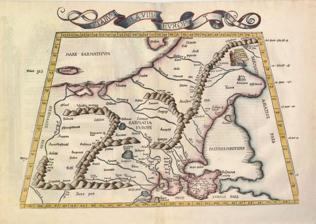
"Tabula VIII Europ.", Ptolemy/Fries

Subject: Eastern Europe

Period: 1535 (published)

Publication: Claudii Ptolemaei Alexandrini Geographicae…

Color: Hand Color

Size:
18.3 x 12.8 inches
46.5 x 32.5 cm
Download High Resolution Image
(or just click on image to launch the Zoom viewer)

A superb Ptolemaic map of Eastern Europe, known in ancient times as Sarmatia, and encompassing the region between the Baltic and Black Seas and between the Vistua and Volga Rivers. The map is typically Ptolemaic - drawn on a revised conical projection and set in a trapezoidal frame. The title is in a banner in the upper margin. The Latin text on the verso is flanked by ornate woodblock designs, presumably the work of Hans Holbein the Younger and Urs Graf.

References: Mickwitz & Miekkavaara (Nordenskiold ) #209-20.

Condition: A

The usual binding holes on centerfold have been neatly repaired.

Estimate: $800 - $1,000

Sold for: $850

Closed on 9/23/2009

Archived