Catalog Archive
Auction 129, Lot 533

"Argentoratum Strassburg", Braun & Hogenberg

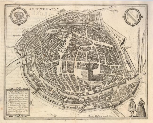
Subject: Strasbourg, France

Period: 1600 (circa)

Publication: Civitates Orbis Terrarum

Color: Black & White

Size:
16.5 x 13.2 inches
41.9 x 33.5 cm
Download High Resolution Image
(or just click on image to launch the Zoom viewer)

Braun & Hogenberg's Civitates Orbis Terrarum or "Cities of the World" was published between 1572 and 1617. Within the six volumes, 531 towns and cities were depicted on 363 plates, providing the reader with the pleasures of travel without the attendant discomforts. Braun wrote in the preface to the third book, "What could be more pleasant than, in one's own home far from all danger, to gaze in these books at the universal form of the earth . . . adorned with the splendor of cities and fortresses and, by looking at pictures and reading the texts accompanying them, to acquire knowledge which could scarcely be had but by long and difficult journeys?" Braun and Hogenberg incorporated an astonishing wealth of information into each scene beyond the city layout and important buildings. The plates provide an impression of the economy and prominent occupations, and illustrate local costumes, manners and customs.

Impressive bird's-eye plan of the city of Strasbourg in the region of Alsace features the magnificent Cathedrale Notre-Dame-de-Strasbourg. A network of canals and walls surrounds the medieval city, which is now known as the Grande Ile. The plan was drawn by Abraham Hogenberg of Cologne and is based on the 1548 map of Conrad Morant. Two coats of arms including the royal German crest, a strapwork cartouche and a couple overlooking the city decorate the sheet. Latin text on verso.

References: Fussel p. 98.

Condition: B+

Dark impression with two filled worm tracks in the bottom border, else very good.

Estimate: $350 - $450

Sold for: $250

Closed on 9/23/2009

Archived