Catalog Archive
Auction 129, Lot 499

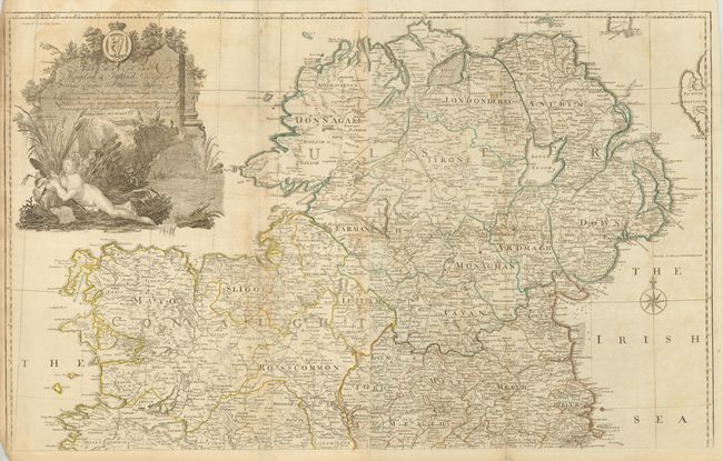
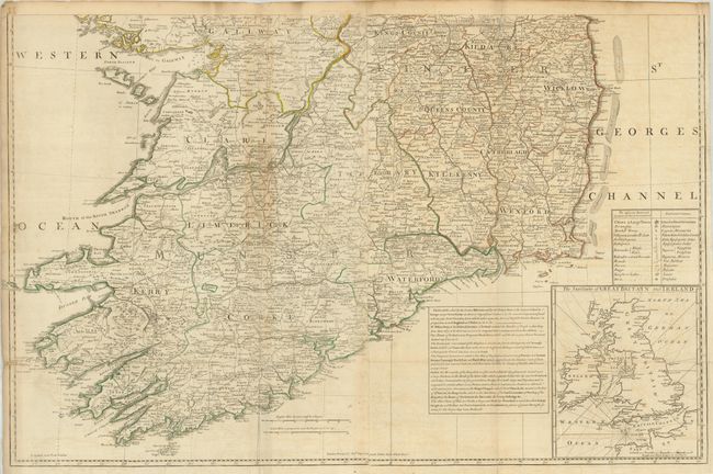
"A Map of the Kingdom of Ireland, Divided into Provinces Counties and Baronies…", Rocque, John

Subject: Ireland

Period: 1782 (published)

Publication: General Atlas

Color: Hand Color

Size:
38 x 23.5 inches
96.5 x 59.7 cm
Download High Resolution Image
(or just click on image to launch the Zoom viewer)

This is a beautifully designed, large-scale map of Ireland. It is engraved with an incredible amount of detail including the locations of hundreds of towns and villages, castles, roads, forests, boggs, ferries, barracks, and forts. An inset map in the lower right quadrant shows Ireland in the context of the British Isles and an explanation text block provides a short description of Ireland. One notation reads, "The Climate of Ireland is very Temperate, the Soil very fertile and the Air so pure that no Venomous Animal can Live in it." The map is graced by a large cartouche that features a comely, Celtic river goddess. Printed for Robert Sayer with his imprint above the bottom border. Printed on four sheets, joined in two horizontal pairs, each measuring 38 x 23.5" (if these are joined, the map would measure approximately 38 x 47").

References:

Condition: B

Original outline color with some minor toning and offsetting. There are a few minor repaired tears and light stains.

Estimate: $600 - $800

Sold for: $450

Closed on 9/23/2009

Archived