Catalog Archive
Auction 129, Lot 490

"A New and Accurate Map of the Post Roads of England and Wales, with the Distances by the Mile Stones", Anon.

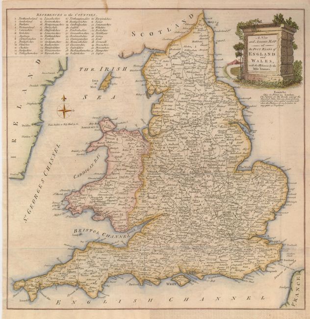
Subject: England & Wales

Period: 1765 (published)

Publication: Universal Magazine

Color: Hand Color

Size:
13 x 13.3 inches
33 x 33.8 cm
Download High Resolution Image
(or just click on image to launch the Zoom viewer)

The extensive postal road system throughout England and Wales is the subject of this attractive map. The distances are given between towns and as noted below the cartouche, the "Figures when added together will shew the Distance from London to any part of England." The cartouche is engraved onto the face of a mile stone and the counties are listed at upper right.

References: Jolly UNIV-121.

Condition: B+

Issued folded, now flattened with a couple fold intersections reinforced on verso with light tissue. The binding trim has been replaced with facsimile of the neatline at bottom left.

Estimate: $200 - $250

Unsold

Closed on 9/23/2009

Archived