Catalog Archive
Auction 129, Lot 470

"Holy Iland [on sheet with] Garnsey [and] Farne [and] Iarsey", Speed, John

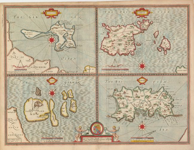
Subject: British Islands

Period: 1610 (dated)

Publication: Theatre of the Empire of Great Britaine

Color: Hand Color

Size:
20 x 15 inches
50.8 x 38.1 cm
Download High Resolution Image
(or just click on image to launch the Zoom viewer)

This folio sheet has four maps finely engraved by Jodocus Hondius for Speed in 1610 as noted in the imprint at lower left. The islands of Holy Island and Farne (Lindisfarne), off the Northumberland coast are shown at left, and at right are Guernsey and Jersey. The islands are described in the English text on verso. Each map is embellished with a compass rose, title and scale cartouche. At the bottom, the cartouche includes the coat of arms with two cherubs and the imprint of Bassett and Chiswell indicating it was published in 1676.

References:

Condition: B+

There is a small paper puncture in the map of Jersey (to the right of the cartouche) that has been closed on verso with archival tape. There are a couple minor extraneous creases.

Estimate: $375 - $450

Sold for: $275

Closed on 9/23/2009

Archived