Catalog Archive
Auction 129, Lot 44

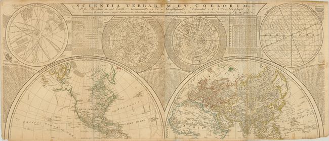
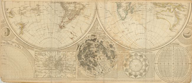
"Scientia Terrarum et Coelorum: Or the Heavens and Earth Astronomically and Geographically Delineated and Display'd…", Dunn, Samuel

Subject: World & Celestial

Period: 1781 (dated)

Publication: General Atlas

Color: Hand Color

Size:
48 x 20.5 inches
121.9 x 52.1 cm
Download High Resolution Image
(or just click on image to launch the Zoom viewer)

This is one of the most well-known wall maps from the latter part of the 18th century. The huge double-hemisphere map of the world is surrounded by celestial and astronomical maps, an inset world map on Mercator's projection, a map of the moon, and a fascinating explanation of the Vicissitude of Seasons (with a great graphic of the sun). The map was first issued in 1772 and was updated and reissued several times over a 30 year period. This is the Sayer and Bennett edition with several important updates, including the complete set of tracks for the three voyages of Capt. Cook. It shows his discoveries in Australia and New Zealand, and those he made in the North Pacific on his third and final voyage. Printed on four sheets (in this case with the upper and lower pairs joined as issued). The size is for the joined sheets; if they were joined the map would measure 48 x 41".

References:

Condition: C

Original outline color. The map has several minor tears, repairs, and stains, including some minor paper loss along the fold through the Eastern Hemisphere and slight loss in the bottom corners. The paper is sound and the map would be stunning with a modest investment in professional conservation.

Estimate: $1,600 - $2,000

Sold for: $1,400

Closed on 9/23/2009

Archived