Catalog Archive
Auction 129, Lot 38

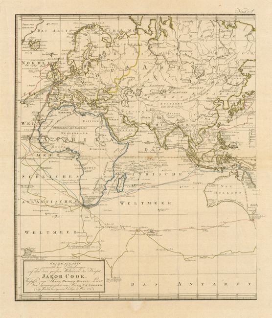
"Generalkarte Soemmtlicher Entdeckungen auf den drei Grossen Weltreisen des Kapit. Jakob Cook. Verflast von Herrn Heinrich Roberts…", Schraembl, Franz Anton
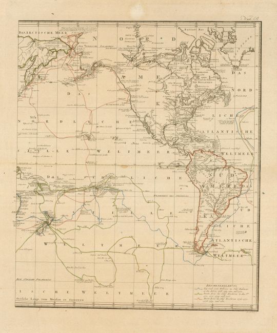
Subject: World

Period: 1789 (dated)

Publication:

Color: Hand Color

Size:
17.5 x 20.5 inches
44.5 x 52.1 cm
Download High Resolution Image
(or just click on image to launch the Zoom viewer)

This large, two-sheet map of the world is presented on Mercator's Projection. It marks the routes taken by Captain Cook on his three expeditions, centered on the Pacific Ocean, where Cook's most important discoveries were made. The map is based on the important map by Lieutenant Henry Roberts, who compiled the surveys for the official account of the voyage. The tracks detail the voyages, each distinguished by a different color, with dates of important discoveries noted. Two sheets, unjoined, as issued; dimensions are for each sheet.

References:

Condition: A

There are small stains on the centerfolds, still overall very good.

Estimate: $1,200 - $1,400

Sold for: $1,800

Closed on 9/23/2009

Archived